Tirano night lights from space
Night Light of Tirano (Lombardy) from space (Italy) Src. Average luminocity for 10x10km area is 10.1591% and for 50x50km: 4.4562%.
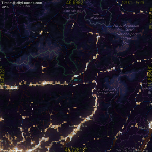
Analysis of Tirano night lights 2016
Square area 10x10 km:
 1.28%
1.28%90-99
1.7%80-89
0.99%70-79
0%60-69
0.99%50-59
1.28%40-49
1.85%30-39
0.99%20-29
2.13%10-19
1.28%0-9
87.5%Square area 50x50 km:
0.33%90-99
0.67%80-89
0.41%70-79
0.45%60-69
0.69%50-59
0.84%40-49
0.69%30-39
0.51%20-29
0.61%10-19
2.05%0-9
92.76%Clear (daylight) street map image can be seen on geolist.org.
Map coordinates:
46° 41' 57.1" North, 9° 27' 36.8" East
46° 12' 53.4" North, 10° 9' 48.1" East
45° 43' 34.1" North, 10° 51' 59.3" East
Some cities around Tirano sort by population:
• Sondrio
23.1 km =14.4 mi,  257°
257°
• Darfo Boario Terme
36 km =22.4 mi,  176°
176°
• Morbegno
46.2 km =28.7 mi, 259°
• Costa Volpino
43.3 km =26.9 mi,  186°
186°
• Clusone
40.1 km =24.9 mi,  204°
204°
• Lovere
45.2 km =28.1 mi, 189°
• Pisogne
45.4 km =28.2 mi, 185°
• Cosio Valtellino
47.9 km =29.8 mi, 259°
3165647 (p: 8,348)
Sources (retrieved 2019-11-25):
» Earth at Night: Flat Maps 2012, 2016