Cosio Valtellino night lights from space
Night Light of Cosio Valtellino (Lombardy) from space (Italy) Src. Average luminocity for 10x10km area is 21.1946% and for 50x50km: 6.3174%.
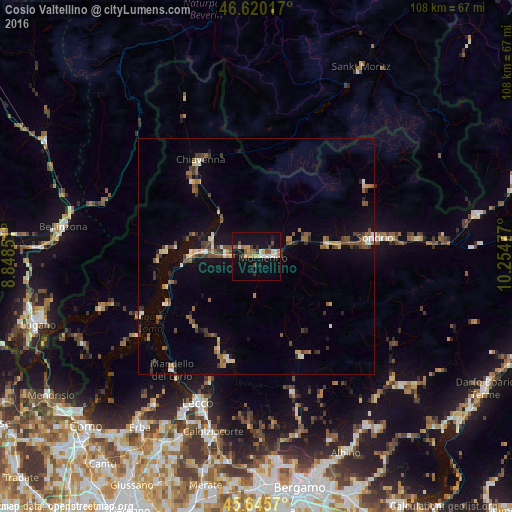
Analysis of Cosio Valtellino night lights 2016
Square area 10x10 km:
 1.7%
1.7%90-99
3.41%80-89
1.14%70-79
4.26%60-69
2.56%50-59
2.27%40-49
4.97%30-39
0.71%20-29
1.99%10-19
25%0-9
51.99%Square area 50x50 km:
0.36%90-99
0.71%80-89
0.73%70-79
0.65%60-69
0.75%50-59
1.26%40-49
1.23%30-39
1.14%20-29
0.83%10-19
3.64%0-9
88.7%Clear (daylight) street map image can be seen on geolist.org.
Map coordinates:
46° 37' 12.6" North, 8° 50' 54.6" East
46° 8' 6.3" North, 9° 33' 5.9" East
45° 38' 44.5" North, 10° 15' 17.2" East
Some cities around Cosio Valtellino sort by population:
• Lecco
33.3 km =20.7 mi,  201°
201°
• Sondrio
24.9 km =15.5 mi,  81°
81°
• Valmadrera-Caserta
35.4 km =22 mi, 204°
• Morbegno
1.8 km =1.1 mi, 82°
• Mandello del Lario
29.7 km =18.5 mi,  217°
217°
• Chiavenna
23.8 km =14.8 mi,  330°
330°
• Colico Piano
13.4 km =8.3 mi,  268°
268°
• Canzo
38.5 km =23.9 mi,  214°
214°
6534726 (p: 5,135)
Sources (retrieved 2019-11-25):
» Earth at Night: Flat Maps 2012, 2016