Solarino night lights from space
Night Light of Solarino (Sicily) from space (Italy) Src. Average luminocity for 10x10km area is 27.5612% and for 50x50km: 16.4869%.
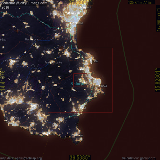
Analysis of Solarino night lights 2016
Square area 10x10 km:
 1.87%
1.87%90-99
2.72%80-89
3.57%70-79
6.29%60-69
3.4%50-59
2.21%40-49
6.46%30-39
8.33%20-29
9.52%10-19
18.03%0-9
37.59%Square area 50x50 km:
2.05%90-99
2%80-89
2.5%70-79
2.2%60-69
2.41%50-59
1.87%40-49
2.22%30-39
3.45%20-29
4.31%10-19
11.18%0-9
65.81%Clear (daylight) street map image can be seen on geolist.org.
Map coordinates:
37° 39' 36.3" North, 14° 25' 0.3" East
37° 6' 4.9" North, 15° 7' 11.6" East
36° 32' 18.6" North, 15° 49' 22.8" East
Some cities around Solarino sort by population:
• Siracusa
15.1 km =9.4 mi,  101°
101°
• Augusta
17.9 km =11.1 mi,  30°
30°
• Floridia
3.6 km =2.2 mi,  123°
123°
• Priolo Gargallo
8.2 km =5.1 mi,  42°
42°
• Sortino
10.2 km =6.3 mi,  308°
308°
• Canicattini Bagni
9.2 km =5.7 mi,  212°
212°
• Melilli
8.6 km =5.3 mi,  6°
6°
• Belvedere
8.4 km =5.2 mi, 99°
2523066 (p: 7,220)
Sources (retrieved 2019-11-25):
» Earth at Night: Flat Maps 2012, 2016