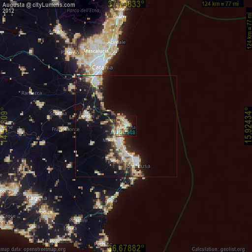
Augusta night lights from space
Night Light of Augusta (Sicily) from space (Italy) Src. Average luminocity for 10x10km area is 47.9762% and for 50x50km: 14.4912%.
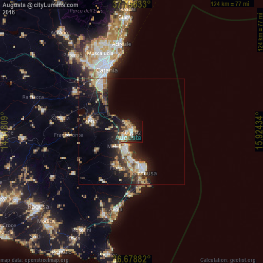
Analysis of Augusta night lights 2016
Square area 10x10 km:
 9.52%
9.52%90-99
5.61%80-89
7.14%70-79
12.24%60-69
8.16%50-59
3.74%40-49
5.78%30-39
7.31%20-29
8.84%10-19
16.5%0-9
15.14%Square area 50x50 km:
2.03%90-99
1.93%80-89
1.98%70-79
1.87%60-69
2%50-59
1.57%40-49
2.1%30-39
3.03%20-29
4.3%10-19
10.33%0-9
68.86%Clear (daylight) street map image can be seen on geolist.org.
Map coordinates:
37° 47' 54" North, 14° 31' 5.1" East
37° 14' 26.3" North, 15° 13' 16.4" East
36° 40' 43.8" North, 15° 55' 27.6" East
Some cities around Augusta sort by population:
• Siracusa
19.3 km =12 mi,  162°
162°
• Floridia
18.5 km =11.5 mi,  198°
198°
• Carlentini
19.2 km =11.9 mi,  283°
283°
• Priolo Gargallo
10.1 km =6.3 mi, 199°
• Sortino
19.2 km =11.9 mi,  241°
241°
• Solarino
17.9 km =11.1 mi,  210°
210°
• Melilli
10.6 km =6.6 mi,  229°
229°
• Belvedere
16.9 km =10.5 mi,  182°
182°
2525646 (p: 30,723)
Sources (retrieved 2019-11-25):
» Earth at Night: Flat Maps 2012, 2016