Rapallo night lights from space
Night Light of Rapallo (Liguria) from space (Italy) Src. Average luminocity for 10x10km area is 33.3254% and for 50x50km: 9.9239%.
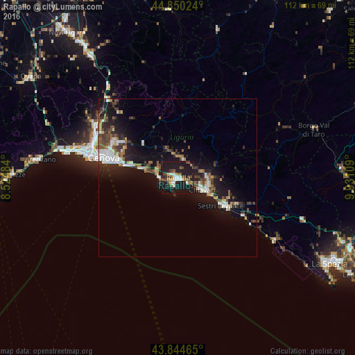
Analysis of Rapallo night lights 2016
Square area 10x10 km:
 4.13%
4.13%90-99
5.4%80-89
1.75%70-79
3.33%60-69
4.92%50-59
3.97%40-49
7.94%30-39
3.49%20-29
5.08%10-19
57.46%0-9
2.54%Square area 50x50 km:
1.52%90-99
1.58%80-89
0.76%70-79
0.58%60-69
1.29%50-59
1.44%40-49
1.61%30-39
1.83%20-29
2.7%10-19
10.25%0-9
76.43%Clear (daylight) street map image can be seen on geolist.org.
Map coordinates:
44° 51' 0.9" North, 8° 31' 29.4" East
44° 20' 58.6" North, 9° 13' 40.7" East
43° 50' 40.7" North, 9° 55' 51.9" East
Some cities around Rapallo sort by population:
• Genoa
23.4 km =14.5 mi,  285°
285°
• Chiavari
8.3 km =5.2 mi,  115°
115°
• Sestri Levante
15.9 km =9.9 mi, 122°
• Lavagna
11.1 km =6.9 mi, 115°
• Recco
6.9 km =4.3 mi,  281°
281°
• Santa Margherita Ligure
2.1 km =1.3 mi,  217°
217°
• Serra Riccò
29.2 km =18.1 mi,  307°
307°
• Casarza Ligure
19.5 km =12.1 mi, 116°
3169602 (p: 26,993)
Sources (retrieved 2019-11-25):
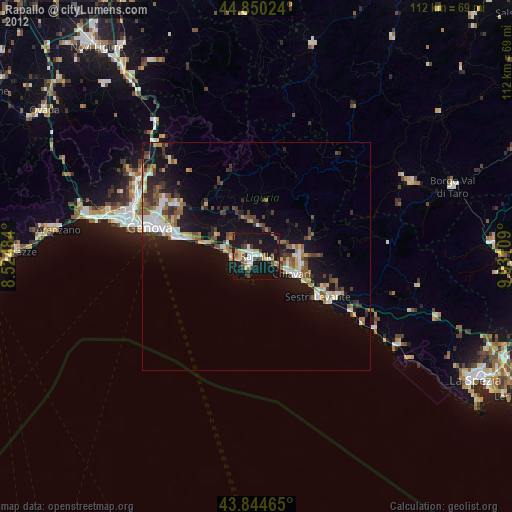
» Earth at Night: Flat Maps 2012, 2016