Ceparana-Carpena night lights from space
Night Light of Ceparana-Carpena (Liguria) from space (Italy) Src. Average luminocity for 10x10km area is 35.5409% and for 50x50km: 11.3278%.
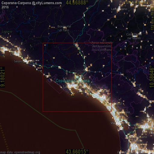
Analysis of Ceparana-Carpena night lights 2016
Square area 10x10 km:
 3.33%
3.33%90-99
4.09%80-89
4.09%70-79
3.64%60-69
6.21%50-59
6.67%40-49
8.94%30-39
7.88%20-29
15.61%10-19
20.76%0-9
18.79%Square area 50x50 km:
1.68%90-99
1.93%80-89
1.01%70-79
1.05%60-69
1.44%50-59
1.72%40-49
2.16%30-39
1.95%20-29
4.31%10-19
6.33%0-9
76.42%Clear (daylight) street map image can be seen on geolist.org.
Map coordinates:
44° 40' 8" North, 9° 10' 48.8" East
44° 10' 0" North, 9° 52' 60" East
43° 39' 36.5" North, 10° 35' 11.3" East
Some cities around Ceparana-Carpena sort by population:
• La Spezia
8.5 km =5.3 mi,  213°
213°
• Marina di Carrara
19 km =11.8 mi,  138°
138°
• Sarzana
8.8 km =5.5 mi,  134°
134°
• Lerici
10.3 km =6.4 mi,  167°
167°
• Santo Stefano di Magra
3.7 km =2.3 mi,  122°
122°
• Colombiera-Molicciara
13.4 km =8.3 mi, 130°
• Casano-Dogana-Isola
15.7 km =9.8 mi, 130°
• Arcola
5.9 km =3.7 mi,  157°
157°
3179149 (p: 5,951)
Sources (retrieved 2019-11-25):
» Earth at Night: Flat Maps 2012, 2016