Arcola night lights from space
Night Light of Arcola (Liguria) from space (Italy) Src. Average luminocity for 10x10km area is 53.5803% and for 50x50km: 12.2866%.
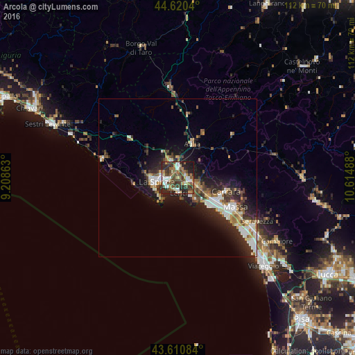
Analysis of Arcola night lights 2016
Square area 10x10 km:
 9.09%
9.09%90-99
9.39%80-89
5.3%70-79
4.55%60-69
8.33%50-59
9.09%40-49
18.03%30-39
8.94%20-29
21.97%10-19
5.3%0-9
0%Square area 50x50 km:
1.9%90-99
2.37%80-89
1.1%70-79
1.14%60-69
1.43%50-59
1.7%40-49
2.07%30-39
2.06%20-29
4.78%10-19
6.94%0-9
74.51%Clear (daylight) street map image can be seen on geolist.org.
Map coordinates:
44° 37' 13.4" North, 9° 12' 31.1" East
44° 7' 4" North, 9° 54' 42.3" East
43° 36' 39" North, 10° 36' 53.6" East
Some cities around Arcola sort by population:
• La Spezia
7.2 km =4.5 mi,  256°
256°
• Marina di Carrara
13.6 km =8.5 mi,  130°
130°
• Sarzana
4.1 km =2.5 mi,  99°
99°
• Lerici
4.7 km =2.9 mi,  180°
180°
• Santo Stefano di Magra
3.6 km =2.2 mi,  13°
13°
• Colombiera-Molicciara
8.6 km =5.3 mi,  113°
113°
• Casano-Dogana-Isola
10.8 km =6.7 mi,  115°
115°
• Ceparana-Carpena
5.9 km =3.7 mi,  337°
337°
3182908 (p: 5,941)
Sources (retrieved 2019-11-25):
» Earth at Night: Flat Maps 2012, 2016