San Sebastiano night lights from space
Night Light of San Sebastiano (Lombardy) from space (Italy) Src. Average luminocity for 10x10km area is 29.8258% and for 50x50km: 33.0253%.
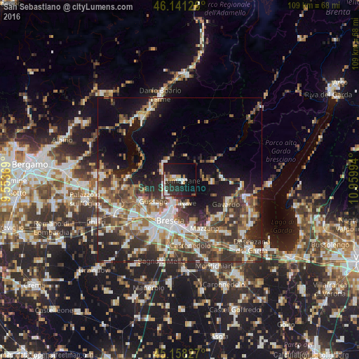
Analysis of San Sebastiano night lights 2016
Square area 10x10 km:
 6.21%
6.21%90-99
5.3%80-89
1.52%70-79
3.03%60-69
1.52%50-59
1.97%40-49
1.97%30-39
4.39%20-29
18.03%10-19
30.91%0-9
25.15%Square area 50x50 km:
5.61%90-99
6.37%80-89
2.6%70-79
3.45%60-69
4.81%50-59
6.1%40-49
6.04%30-39
7.09%20-29
8.99%10-19
12.41%0-9
36.53%Clear (daylight) street map image can be seen on geolist.org.
Map coordinates:
46° 8' 28.5" North, 9° 33' 13.3" East
45° 39' 6.9" North, 10° 15' 24.5" East
45° 9' 29.8" North, 10° 57' 35.8" East
Some cities around San Sebastiano sort by population:
• Lumezzane
0.8 km =0.5 mi,  125°
125°
• Piazza
10.7 km =6.6 mi,  227°
227°
• Sarezzo
4.8 km =3 mi,  281°
281°
• Concesio
6.1 km =3.8 mi,  210°
210°
• Nave
7.7 km =4.8 mi,  166°
166°
• Villa Carcina
5.2 km =3.2 mi,  246°
246°
• Gardone Val Trompia
7 km =4.3 mi,  308°
308°
• Bovezzo
7 km =4.3 mi,  189°
189°
3167744 (p: 23,228)
Sources (retrieved 2019-11-25):
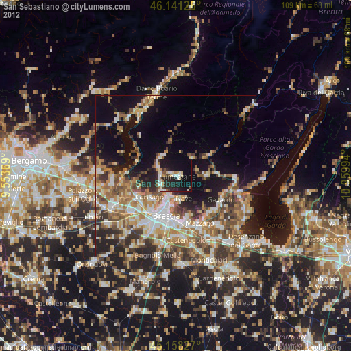
» Earth at Night: Flat Maps 2012, 2016