San Giovanni Valdarno night lights from space
Night Light of San Giovanni Valdarno (Tuscany) from space (Italy) Src. Average luminocity for 10x10km area is 33.9206% and for 50x50km: 11.5862%.
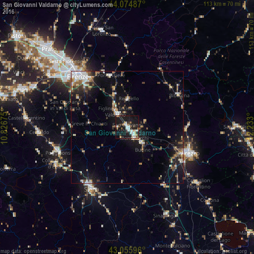
Analysis of San Giovanni Valdarno night lights 2016
Square area 10x10 km:
 6.03%
6.03%90-99
8.89%80-89
2.38%70-79
3.17%60-69
2.38%50-59
2.38%40-49
2.7%30-39
3.02%20-29
9.52%10-19
48.41%0-9
11.11%Square area 50x50 km:
1.54%90-99
1.97%80-89
1.2%70-79
0.76%60-69
1.42%50-59
1.56%40-49
1.8%30-39
1.55%20-29
2.85%10-19
9.55%0-9
75.8%Clear (daylight) street map image can be seen on geolist.org.
Map coordinates:
44° 4' 29.5" North, 10° 49' 36.3" East
43° 34' 3.3" North, 11° 31' 47.5" East
43° 3' 21.5" North, 12° 13' 58.8" East
Some cities around San Giovanni Valdarno sort by population:
• Montevarchi
5.8 km =3.6 mi,  143°
143°
• Figline Valdarno
7.5 km =4.7 mi,  321°
321°
• Pontassieve
24.4 km =15.2 mi,  340°
340°
• Grassina Ponte a Ema
26.1 km =16.2 mi,  314°
314°
• Tavarnelle Val di Pesa
28.9 km =18 mi,  268°
268°
• Bibbiena
27.2 km =16.9 mi,  57°
57°
• Terranuova Bracciolini
4.5 km =2.8 mi,  114°
114°
• Bagno a Ripoli
26.4 km =16.4 mi, 320°
3168231 (p: 16,002)
Sources (retrieved 2019-11-25):
» Earth at Night: Flat Maps 2012, 2016