Rosolina night lights from space
Night Light of Rosolina (Veneto) from space (Italy) Src. Average luminocity for 10x10km area is 25.2985% and for 50x50km: 9.9084%.
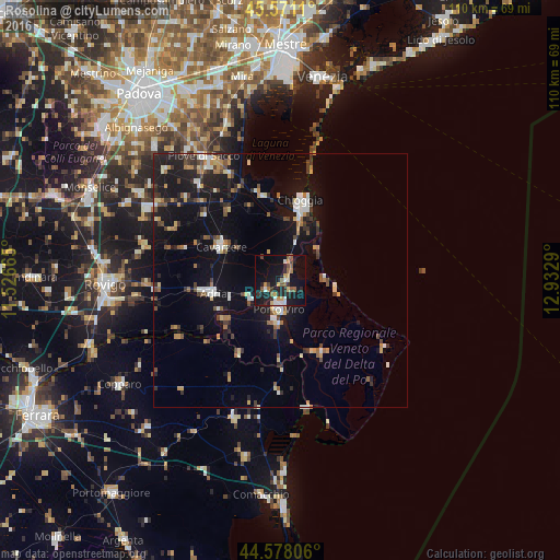
Analysis of Rosolina night lights 2016
Square area 10x10 km:
 2.58%
2.58%90-99
2.88%80-89
2.27%70-79
4.39%60-69
2.73%50-59
5.3%40-49
2.12%30-39
2.42%20-29
6.97%10-19
34.24%0-9
34.09%Square area 50x50 km:
0.87%90-99
1.44%80-89
0.82%70-79
1.08%60-69
1.14%50-59
1.26%40-49
1.43%30-39
1.35%20-29
2.49%10-19
10.62%0-9
77.48%Clear (daylight) street map image can be seen on geolist.org.
Map coordinates:
45° 34' 16" North, 11° 31' 35.9" East
45° 4' 36.3" North, 12° 13' 47.2" East
44° 34' 41" North, 12° 55' 58.4" East
Some cities around Rosolina sort by population:
• Chioggia
16.2 km =10.1 mi,  13°
13°
• Taglio
6.2 km =3.9 mi,  193°
193°
• Porto Viro
5.6 km =3.5 mi, 189°
• Adria
13.9 km =8.6 mi,  259°
259°
• Porto Tolle
16 km =9.9 mi,  152°
152°
• Cavarzere
13.1 km =8.1 mi,  299°
299°
• Taglio di Po
8.4 km =5.2 mi, 188°
• Villadose
26 km =16.2 mi,  268°
268°
3168927 (p: 5,185)
Sources (retrieved 2019-11-25):
» Earth at Night: Flat Maps 2012, 2016