Porto Viro night lights from space
Night Light of Porto Viro (Veneto) from space (Italy) Src. Average luminocity for 10x10km area is 29.9667% and for 50x50km: 9.2066%.
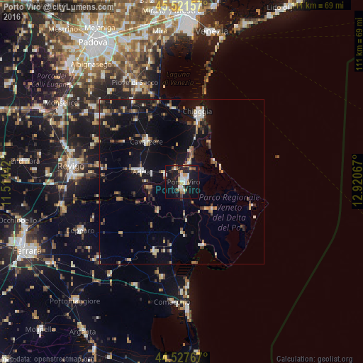
Analysis of Porto Viro night lights 2016
Square area 10x10 km:
 4.76%
4.76%90-99
5.4%80-89
2.22%70-79
4.13%60-69
3.49%50-59
4.13%40-49
1.75%30-39
2.54%20-29
6.67%10-19
41.27%0-9
23.65%Square area 50x50 km:
0.79%90-99
1.38%80-89
0.86%70-79
0.93%60-69
0.98%50-59
1.25%40-49
1.27%30-39
1.18%20-29
1.77%10-19
9.59%0-9
80%Clear (daylight) street map image can be seen on geolist.org.
Map coordinates:
45° 31' 17.7" North, 11° 30' 51.9" East
45° 1' 36.4" North, 12° 13' 3.1" East
44° 31' 39.6" North, 12° 55' 14.4" East
Some cities around Porto Viro sort by population:
• Chioggia
21.8 km =13.5 mi,  12°
12°
• Taglio
0.7 km =0.4 mi,  226°
226°
• Adria
13.1 km =8.1 mi,  283°
283°
• Cavarzere
15.9 km =9.9 mi,  319°
319°
• Taglio di Po
2.8 km =1.7 mi,  185°
185°
• Codigoro
23.3 km =14.5 mi,  201°
201°
• Rosolina
5.6 km =3.5 mi, 9°
• Villadose
25.5 km =15.8 mi, 281°
6534283 (p: 13,644)
Sources (retrieved 2019-11-25):
» Earth at Night: Flat Maps 2012, 2016