Robbiate night lights from space
Night Light of Robbiate (Lombardy) from space (Italy) Src. Average luminocity for 10x10km area is 74.7682% and for 50x50km: 62.5934%.
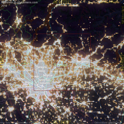
Analysis of Robbiate night lights 2016
Square area 10x10 km:
 18.33%
90-99
17.42%80-89
7.58%70-79
13.03%60-69
16.67%50-59
13.48%40-49
6.52%30-39
6.97%20-29
0%10-19
0%0-9
0%Square area 50x50 km:
22.78%90-99
14.42%80-89
5.59%70-79
7.44%60-69
7.51%50-59
6.13%40-49
5.42%30-39
6.01%20-29
6.11%10-19
6.85%0-9
11.74%Clear (daylight) street map image can be seen on geolist.org.
Map coordinates:
46° 10' 38.3" North, 8° 44' 2.4" East
45° 41' 17.8" North, 9° 26' 13.6" East
45° 11' 41.9" North, 10° 8' 24.9" East
Some cities around Robbiate sort by population:
• Merate
1.3 km =0.8 mi,  271°
271°
• Bernareggio
5.1 km =3.2 mi,  208°
208°
• Usmate-Velate
7.3 km =4.5 mi,  232°
232°
• Cornate d'Adda
7.3 km =4.5 mi,  156°
156°
• Calusco d'Adda
2.6 km =1.6 mi,  89°
89°
• Terno d'Isola
7.3 km =4.5 mi, 92°
• Carnate
6.4 km =4 mi, 225°
• Olgiate Molgora
5.4 km =3.4 mi,  330°
330°
3169213 (p: 5,969)
Sources (retrieved 2019-11-25):
» Earth at Night: Flat Maps 2012, 2016