Mirto night lights from space
Night Light of Mirto (Calabria) from space (Italy) Src. Average luminocity for 10x10km area is 15.0601% and for 50x50km: 5.336%.
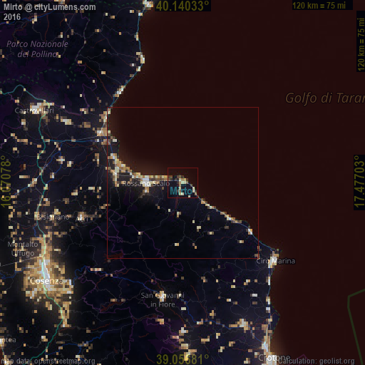
Analysis of Mirto night lights 2016
Square area 10x10 km:
 0%
0%90-99
1.3%80-89
4.55%70-79
0.81%60-69
1.62%50-59
2.6%40-49
1.46%30-39
4.06%20-29
3.41%10-19
1.46%0-9
78.73%Square area 50x50 km:
0.21%90-99
0.83%80-89
0.91%70-79
0.52%60-69
0.67%50-59
0.83%40-49
0.65%30-39
0.8%20-29
0.9%10-19
5.07%0-9
88.59%Clear (daylight) street map image can be seen on geolist.org.
Map coordinates:
40° 8' 25.2" North, 16° 4' 14.8" East
39° 36' 2.5" North, 16° 46' 26" East
39° 3' 24.5" North, 17° 28' 37.3" East
Some cities around Mirto sort by population:
• Rossano Stazione
11.9 km =7.4 mi,  268°
268°
• Corigliano Scalo
22.5 km =14 mi,  277°
277°
• Acri
35.2 km =21.9 mi,  250°
250°
• Trebisacce
36.4 km =22.6 mi,  325°
325°
• Cariati
19.4 km =12.1 mi,  126°
126°
• Marina di Schiavonea
21.3 km =13.2 mi, 284°
• Corigliano Calabro
21.8 km =13.5 mi, 268°
• Rossano
12.3 km =7.6 mi,  257°
257°
2524129 (p: 8,684)
Sources (retrieved 2019-11-25):
» Earth at Night: Flat Maps 2012, 2016