Rossano night lights from space
Night Light of Rossano (Calabria) from space (Italy) Src. Average luminocity for 10x10km area is 27.8555% and for 50x50km: 6.8601%.
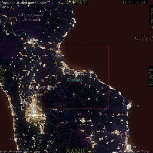
Analysis of Rossano night lights 2016
Square area 10x10 km:
 2.92%
2.92%90-99
6.82%80-89
4.55%70-79
1.79%60-69
4.55%50-59
0.97%40-49
3.73%30-39
3.57%20-29
5.68%10-19
27.27%0-9
38.15%Square area 50x50 km:
0.22%90-99
0.97%80-89
1%70-79
0.6%60-69
0.89%50-59
1.28%40-49
0.93%30-39
1.04%20-29
1.25%10-19
7.05%0-9
84.78%Clear (daylight) street map image can be seen on geolist.org.
Map coordinates:
40° 6' 57.8" North, 15° 55' 52.9" East
39° 34' 34.4" North, 16° 38' 4.1" East
39° 1' 55.7" North, 17° 20' 15.4" East
Some cities around Rossano sort by population:
• Corigliano Scalo
11.8 km =7.3 mi,  298°
298°
• Acri
23.1 km =14.4 mi,  247°
247°
• Mirto
12.3 km =7.6 mi,  77°
77°
• Cariati
28.9 km =18 mi,  107°
107°
• Marina di Schiavonea
11.9 km =7.4 mi,  313°
313°
• Spezzano Albanese
29.7 km =18.5 mi,  290°
290°
• Corigliano Calabro
10.1 km =6.3 mi,  282°
282°
• Bisignano
31.3 km =19.4 mi,  255°
255°
2523578 (p: 5,194)
Sources (retrieved 2019-11-25):
» Earth at Night: Flat Maps 2012, 2016