Manfredonia night lights from space
Night Light of Manfredonia (Apulia) from space (Italy) Src. Average luminocity for 10x10km area is 28.7354% and for 50x50km: 4.1046%.
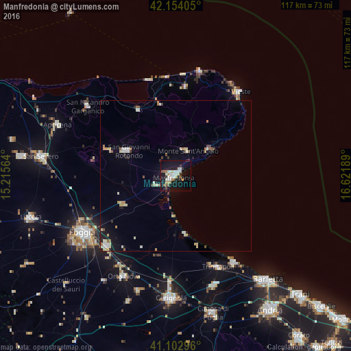
Analysis of Manfredonia night lights 2016
Square area 10x10 km:
 4.71%
4.71%90-99
8.77%80-89
1.14%70-79
2.27%60-69
3.41%50-59
2.44%40-49
2.11%30-39
2.44%20-29
2.27%10-19
41.4%0-9
29.06%Square area 50x50 km:
0.44%90-99
0.93%80-89
0.58%70-79
0.39%60-69
0.46%50-59
0.35%40-49
0.32%30-39
0.3%20-29
0.51%10-19
2.98%0-9
92.74%Clear (daylight) street map image can be seen on geolist.org.
Map coordinates:
42° 9' 14.6" North, 15° 12' 56.3" East
41° 37' 50.3" North, 15° 55' 7.5" East
41° 6' 10.7" North, 16° 37' 18.8" East
Some cities around Manfredonia sort by population:
• San Giovanni Rotondo
18 km =11.2 mi,  297°
297°
• Trinitapoli
33.6 km =20.9 mi,  155°
155°
• San Marco in Lamis
25 km =15.5 mi,  291°
291°
• Monte Sant'Angelo
9 km =5.6 mi,  22°
22°
• Margherita di Savoia
34.8 km =21.6 mi,  145°
145°
• Cagnano Varano
25.1 km =15.6 mi,  331°
331°
• Vico del Gargano
29.7 km =18.5 mi,  6°
6°
• Mattinata
14.2 km =8.8 mi,  50°
50°
3174092 (p: 52,911)
Sources (retrieved 2019-11-25):
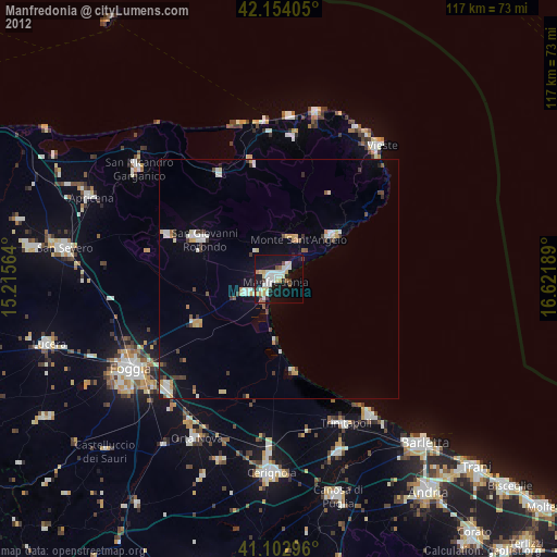
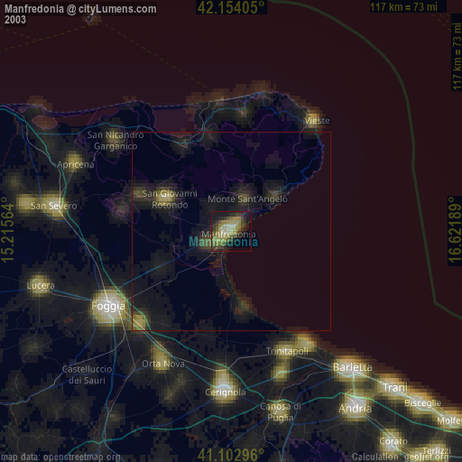
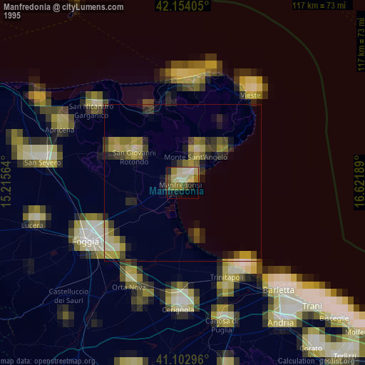
» NASA, Earths city lights 1995
» NASA city lights 2003
» Earth at Night: Flat Maps 2012, 2016