Lizzanello night lights from space
Night Light of Lizzanello (Apulia) from space (Italy) Src. Average luminocity for 10x10km area is 52.881% and for 50x50km: 26.8182%.
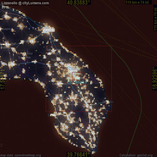
Analysis of Lizzanello night lights 2016
Square area 10x10 km:
 7.48%
7.48%90-99
13.44%80-89
6.97%70-79
5.78%60-69
6.97%50-59
6.63%40-49
6.63%30-39
8.33%20-29
32.65%10-19
5.1%0-9
0%Square area 50x50 km:
3.07%90-99
5%80-89
3.26%70-79
2.94%60-69
3.12%50-59
3%40-49
3.14%30-39
4.86%20-29
13.92%10-19
21.67%0-9
36.03%Clear (daylight) street map image can be seen on geolist.org.
Map coordinates:
40° 50' 19.8" North, 17° 31' 11" East
40° 18' 17.1" North, 18° 13' 22.2" East
39° 45' 59.1" North, 18° 55' 33.5" East
Some cities around Lizzanello sort by population:
• Lecce
7 km =4.3 mi,  322°
322°
• Monteroni di Lecce
11.2 km =7 mi,  278°
278°
• Surbo
12.4 km =7.7 mi, 322°
• Lequile
7 km =4.3 mi,  270°
270°
• Cavallino
1.9 km =1.2 mi,  289°
289°
• Calimera
7.8 km =4.8 mi,  141°
141°
• San Cesario di Lecce
5.3 km =3.3 mi, 266°
• Melendugno
10.4 km =6.5 mi,  110°
110°
3174654 (p: 6,115)
Sources (retrieved 2019-11-25):
» Earth at Night: Flat Maps 2012, 2016