San Cesario di Lecce night lights from space
Night Light of San Cesario di Lecce (Apulia) from space (Italy) Src. Average luminocity for 10x10km area is 61.4813% and for 50x50km: 27.4423%.
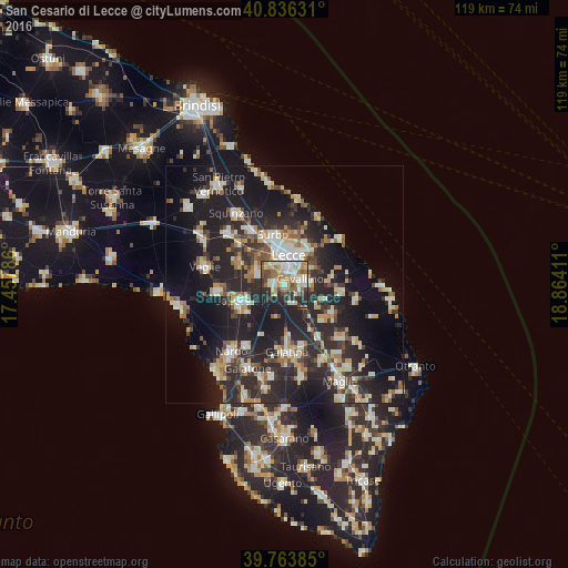
Analysis of San Cesario di Lecce night lights 2016
Square area 10x10 km:
 10.03%
90-99
15.99%80-89
8.33%70-79
9.35%60-69
10.54%50-59
7.82%40-49
7.99%30-39
5.95%20-29
18.2%10-19
5.78%0-9
0%Square area 50x50 km:
3.15%90-99
5.09%80-89
3.26%70-79
3.01%60-69
3.28%50-59
3.03%40-49
3.15%30-39
4.87%20-29
14.01%10-19
22.36%0-9
34.8%Clear (daylight) street map image can be seen on geolist.org.
Map coordinates:
40° 50' 10.7" North, 17° 27' 28.3" East
40° 18' 8" North, 18° 9' 39.5" East
39° 45' 49.9" North, 18° 51' 50.8" East
Some cities around San Cesario di Lecce sort by population:
• Lecce
5.9 km =3.7 mi,  9°
9°
• Copertino
9.8 km =6.1 mi,  247°
247°
• Monteroni di Lecce
6.2 km =3.9 mi,  287°
287°
• Surbo
10.4 km =6.5 mi,  347°
347°
• Carmiano
11.1 km =6.9 mi, 294°
• Lequile
1.8 km =1.1 mi,  282°
282°
• Cavallino
3.6 km =2.2 mi,  75°
75°
• Lizzanello
5.3 km =3.3 mi,  86°
86°
3168484 (p: 7,036)
Sources (retrieved 2019-11-25):
» Earth at Night: Flat Maps 2012, 2016