Lavena Ponte Tresa night lights from space
Night Light of Lavena Ponte Tresa (Lombardy) from space (Italy) Src. Average luminocity for 10x10km area is 22.6979% and for 50x50km: 23.9101%.
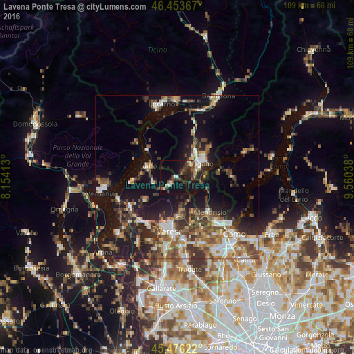
Analysis of Lavena Ponte Tresa night lights 2016
Square area 10x10 km:
 0.45%
0.45%90-99
3.57%80-89
2.08%70-79
1.49%60-69
1.49%50-59
3.57%40-49
4.91%30-39
7.59%20-29
6.7%10-19
32.74%0-9
35.42%Square area 50x50 km:
2.75%90-99
4.16%80-89
2.11%70-79
2.58%60-69
3.52%50-59
4.19%40-49
4.78%30-39
4.8%20-29
6.22%10-19
17.5%0-9
47.39%Clear (daylight) street map image can be seen on geolist.org.
Map coordinates:
46° 27' 13.2" North, 8° 9' 14.9" East
45° 58' 1.6" North, 8° 51' 26.1" East
45° 28' 34.4" North, 9° 33' 37.4" East
Some cities around Lavena Ponte Tresa sort by population:
• Lugano, CH
9.3 km =5.8 mi,  58°
58°
• Luino
9.5 km =5.9 mi,  294°
294°
• Induno Olona
13.6 km =8.5 mi,  185°
185°
• Arcisate
12.4 km =7.7 mi,  176°
176°
• Pregassona, CH
10.8 km =6.7 mi, 56°
• Mendrisio, CH
14.4 km =8.9 mi,  138°
138°
• Viganello, CH
10 km =6.2 mi, 59°
• Massagno, CH
8.4 km =5.2 mi,  52°
52°
3170213 (p: 5,268)
Sources (retrieved 2019-11-25):
» Earth at Night: Flat Maps 2012, 2016