Langhirano night lights from space
Night Light of Langhirano (Emilia-Romagna) from space (Italy) Src. Average luminocity for 10x10km area is 17.2424% and for 50x50km: 18.1485%.
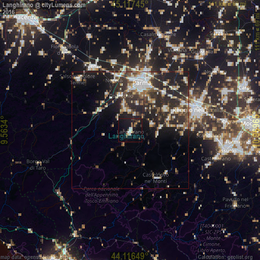
Analysis of Langhirano night lights 2016
Square area 10x10 km:
 1.67%
1.67%90-99
2.42%80-89
0.91%70-79
1.06%60-69
1.82%50-59
1.97%40-49
2.42%30-39
4.09%20-29
2.12%10-19
28.03%0-9
53.48%Square area 50x50 km:
2.63%90-99
3.61%80-89
1.7%70-79
1.69%60-69
1.89%50-59
2.17%40-49
2.55%30-39
4.12%20-29
8.35%10-19
10.79%0-9
60.52%Clear (daylight) street map image can be seen on geolist.org.
Map coordinates:
45° 7' 2.8" North, 9° 33' 48.2" East
44° 37' 8.9" North, 10° 15' 59.5" East
44° 6' 59.4" North, 10° 58' 10.7" East
Some cities around Langhirano sort by population:
• Parma
20.6 km =12.8 mi,  13°
13°
• Cavriago
22.2 km =13.8 mi,  67°
67°
• Montecchio Emilia
17.2 km =10.7 mi,  58°
58°
• Sant'Ilario d'Enza
21.1 km =13.1 mi,  42°
42°
• Noceto
22.3 km =13.9 mi,  341°
341°
• Collecchio
15.3 km =9.5 mi, 344°
• Bibbiano
17.1 km =10.6 mi, 73°
• Traversetolo
9.4 km =5.8 mi, 73°
3175163 (p: 5,894)
Sources (retrieved 2019-11-25):
» Earth at Night: Flat Maps 2012, 2016