L'Aquila night lights from space
Night Light of L'Aquila (Abruzzo) from space (Italy) Src. Average luminocity for 10x10km area is 50.4667% and for 50x50km: 7.8668%.
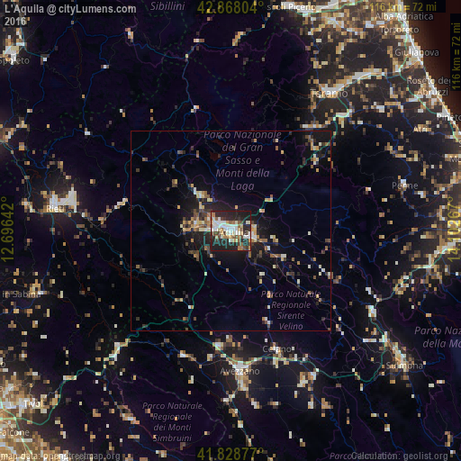
Analysis of L'Aquila night lights 2016
Square area 10x10 km:
 8.1%
8.1%90-99
14.76%80-89
4.92%70-79
3.49%60-69
6.03%50-59
6.51%40-49
6.98%30-39
5.87%20-29
25.87%10-19
17.3%0-9
0.16%Square area 50x50 km:
0.42%90-99
1.43%80-89
0.84%70-79
0.95%60-69
0.92%50-59
1.04%40-49
1.13%30-39
1.43%20-29
2.78%10-19
6%0-9
83.08%Clear (daylight) street map image can be seen on geolist.org.
Map coordinates:
42° 52' 4.9" North, 12° 41' 47.1" East
42° 21' 2" North, 13° 23' 58.3" East
41° 49' 43.6" North, 14° 6' 9.6" East
Some cities around L'Aquila sort by population:
• Rieti
44.9 km =27.9 mi,  277°
277°
• Avezzano
35.8 km =22.2 mi,  176°
176°
• Teramo
42.4 km =26.3 mi,  35°
35°
• Celano
31.5 km =19.6 mi,  162°
162°
• Penne
44.9 km =27.9 mi,  75°
75°
• Luco dei Marsi
43.9 km =27.3 mi,  172°
172°
• Popoli
40.8 km =25.4 mi,  119°
119°
• Montorio al Vomano
32.2 km =20 mi, 37°
3175121 (p: 33,691)
Sources (retrieved 2019-11-25):
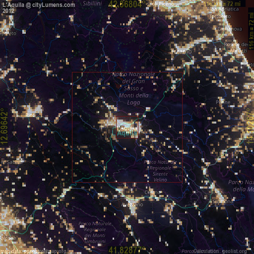
» Earth at Night: Flat Maps 2012, 2016