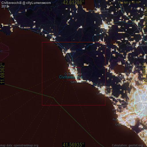
Civitavecchia night lights from space
Night Light of Civitavecchia (Latium) from space (Italy) Src. Average luminocity for 10x10km area is 37.8258% and for 50x50km: 5.4233%.
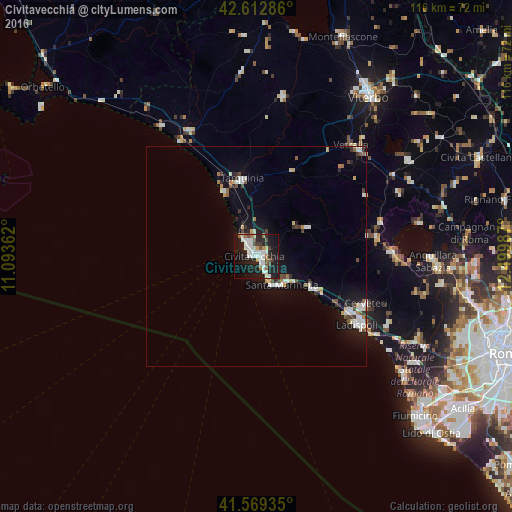
Analysis of Civitavecchia night lights 2016
Square area 10x10 km:
 8.64%
8.64%90-99
10.91%80-89
2.27%70-79
2.12%60-69
2.42%50-59
3.79%40-49
3.03%30-39
2.73%20-29
12.73%10-19
37.58%0-9
13.79%Square area 50x50 km:
0.87%90-99
1.18%80-89
0.51%70-79
0.36%60-69
0.4%50-59
0.5%40-49
0.57%30-39
0.62%20-29
1.02%10-19
4.6%0-9
89.36%Clear (daylight) street map image can be seen on geolist.org.
Map coordinates:
42° 36' 46.3" North, 11° 5' 37" East
42° 5' 35.7" North, 11° 47' 48.3" East
41° 34' 9.7" North, 12° 29' 59.5" East
Some cities around Civitavecchia sort by population:
• Ladispoli
27.9 km =17.3 mi,  124°
124°
• Cerveteri
26.8 km =16.7 mi, 115°
• Santa Marinella
8.1 km =5 mi,  144°
144°
• Bracciano
30.5 km =19 mi,  88°
88°
• Tarquinia
18.2 km =11.3 mi,  349°
349°
• Vetralla
33.8 km =21 mi,  42°
42°
• Marina di Cerveteri
24.6 km =15.3 mi, 120°
• Manziana
27.4 km =17 mi,  81°
81°
3178587 (p: 47,543)
Sources (retrieved 2019-11-25):
» Earth at Night: Flat Maps 2012, 2016