Ladispoli night lights from space
Night Light of Ladispoli (Latium) from space (Italy) Src. Average luminocity for 10x10km area is 31.8143% and for 50x50km: 18.3019%.
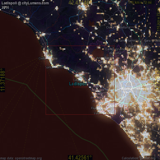
Analysis of Ladispoli night lights 2016
Square area 10x10 km:
 6.35%
6.35%90-99
7.94%80-89
3.17%70-79
2.22%60-69
2.54%50-59
2.86%40-49
2.06%30-39
4.29%20-29
5.08%10-19
37.94%0-9
25.56%Square area 50x50 km:
3.25%90-99
3.97%80-89
1.88%70-79
1.84%60-69
2.26%50-59
2.44%40-49
1.79%30-39
1.97%20-29
4.46%10-19
12.39%0-9
63.76%Clear (daylight) street map image can be seen on geolist.org.
Map coordinates:
42° 28' 17.3" North, 11° 22' 18.8" East
41° 57' 2.4" North, 12° 4' 30" East
41° 25' 32.2" North, 12° 46' 41.3" East
Some cities around Ladispoli sort by population:
• Cerveteri
4.6 km =2.9 mi,  16°
16°
• Anguillara Sabazia
22.4 km =13.9 mi,  50°
50°
• Santa Marinella
20.5 km =12.7 mi,  296°
296°
• Bracciano
18.5 km =11.5 mi, 23°
• Marina di Cerveteri
3.7 km =2.3 mi,  330°
330°
• Fregene
15 km =9.3 mi,  137°
137°
• Ara Nova
13.8 km =8.6 mi,  98°
98°
• Manziana
20.4 km =12.7 mi,  11°
11°
3175298 (p: 34,204)
Sources (retrieved 2019-11-25):
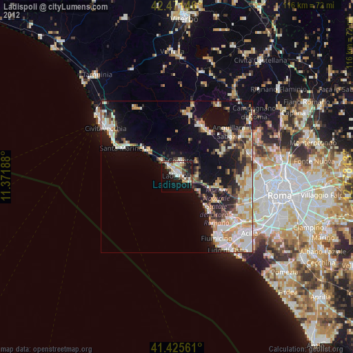
» Earth at Night: Flat Maps 2012, 2016