Capannori night lights from space
Night Light of Capannori (Tuscany) from space (Italy) Src. Average luminocity for 10x10km area is 63.1079% and for 50x50km: 29.4656%.
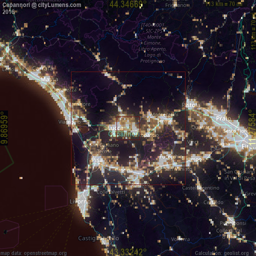
Analysis of Capannori night lights 2016
Square area 10x10 km:
 9.21%
9.21%90-99
15.08%80-89
5.87%70-79
8.25%60-69
15.08%50-59
14.76%40-49
8.57%30-39
9.84%20-29
13.33%10-19
0%0-9
0%Square area 50x50 km:
3.5%90-99
5.05%80-89
2.55%70-79
3.66%60-69
3.81%50-59
4.37%40-49
5.48%30-39
5.37%20-29
13.56%10-19
21.33%0-9
31.33%Clear (daylight) street map image can be seen on geolist.org.
Map coordinates:
44° 20' 48.1" North, 9° 52' 10.5" East
43° 50' 30.2" North, 10° 34' 21.8" East
43° 19' 56.7" North, 11° 16' 33" East
Some cities around Capannori sort by population:
• Lucca
5.5 km =3.4 mi,  272°
272°
• Pescia
10.6 km =6.6 mi,  61°
61°
• Altopascio
8.8 km =5.5 mi,  108°
108°
• Borgo a Buggiano
13.5 km =8.4 mi,  74°
74°
• Porcari
3.5 km =2.2 mi,  90°
90°
• Margine Coperta-Traversagna
15.4 km =9.6 mi, 74°
• Pontasserchio
14.3 km =8.9 mi,  241°
241°
• Bientina
15.3 km =9.5 mi,  165°
165°
3180733 (p: 41,116)
Sources (retrieved 2019-11-25):
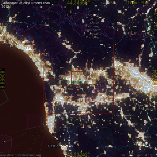
» Earth at Night: Flat Maps 2012, 2016