Vasco da Gama night lights from space
Night Light of Vasco da Gama (Goa) from space (India) Src. Average luminocity for 10x10km area is 58.7403% and for 50x50km: 34.1002%.
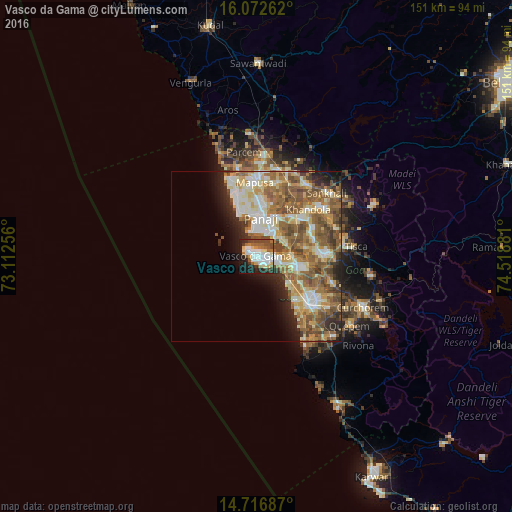
Analysis of Vasco da Gama night lights 2016
Square area 10x10 km:
 14.94%
90-99
15.8%80-89
6.93%70-79
2.81%60-69
6.49%50-59
9.31%40-49
9.96%30-39
5.19%20-29
12.55%10-19
13.85%0-9
2.16%Square area 50x50 km:
4.08%90-99
8.03%80-89
5.06%70-79
4.26%60-69
6.86%50-59
8.55%40-49
5.97%30-39
2.86%20-29
4.72%10-19
5.28%0-9
44.32%Clear (daylight) street map image can be seen on geolist.org.
Map coordinates:
16° 4' 21.4" North, 73° 6' 45.2" East
15° 23' 45.1" North, 73° 48' 56.4" East
14° 43' 0.7" North, 74° 31' 7.7" East
Some cities around Vasco da Gama sort by population:
• Mormugao
0.8 km =0.5 mi,  186°
186°
• Panaji
11.2 km =7 mi,  5°
5°
• Taleigao
8.4 km =5.2 mi, 12°
• Sancoale
9.6 km =6 mi,  101°
101°
• Chicalim
2.9 km =1.8 mi,  84°
84°
• Cortalim
10 km =6.2 mi,  85°
85°
• Goa Velha
9.2 km =5.7 mi,  54°
54°
• Bambolim
8.5 km =5.3 mi,  28°
28°
1253367 (p: 100,485)
Sources (retrieved 2019-11-25):
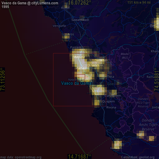
» NASA, Earths city lights 1995
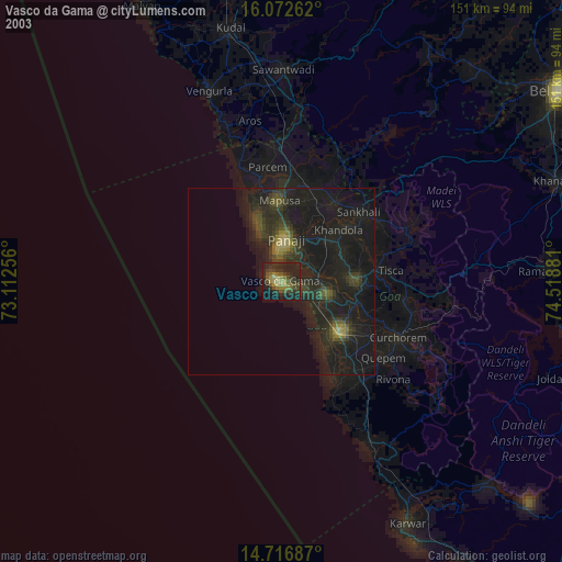
» NASA city lights 2003
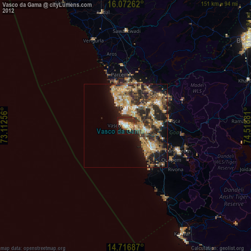
» Earth at Night: Flat Maps 2012, 2016