Varangaon night lights from space
Night Light of Varangaon (Maharashtra) from space (India) Src. Average luminocity for 10x10km area is 28.3571% and for 50x50km: 11.544%.
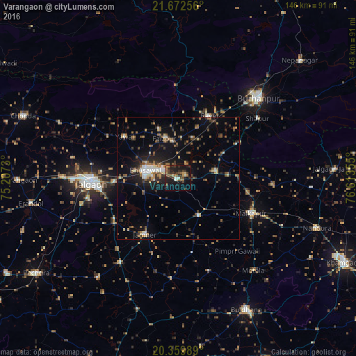
Analysis of Varangaon night lights 2016
Square area 10x10 km:
 0.4%
0.4%90-99
4.17%80-89
2.18%70-79
2.58%60-69
5.75%50-59
4.56%40-49
7.34%30-39
7.14%20-29
10.71%10-19
30.36%0-9
24.8%Square area 50x50 km:
0.57%90-99
1.47%80-89
0.95%70-79
1.13%60-69
2.29%50-59
1.93%40-49
1.84%30-39
2.38%20-29
2.88%10-19
7.64%0-9
76.91%Clear (daylight) street map image can be seen on geolist.org.
Map coordinates:
21° 40' 21.2" North, 75° 12' 26.3" East
21° 1' 3.6" North, 75° 54' 37.5" East
20° 21' 35.6" North, 76° 36' 48.8" East
Some cities around Varangaon sort by population:
• Jalgaon
35.8 km =22.2 mi,  267°
267°
• Bhusāval
13.3 km =8.3 mi,  282°
282°
• Malkāpur
33.4 km =20.8 mi,  116°
116°
• Yāval
27.7 km =17.2 mi,  307°
307°
• Rāver
28.6 km =17.8 mi,  26°
26°
• Faizpur
17.5 km =10.9 mi,  342°
342°
• Sāvda
14.9 km =9.3 mi,  351°
351°
• Shāhpur
40.8 km =25.4 mi,  53°
53°
1253403 (p: 44,067)
Sources (retrieved 2019-11-25):
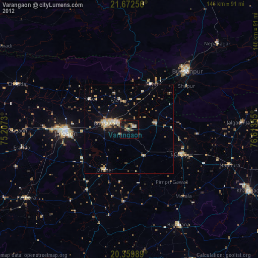
» Earth at Night: Flat Maps 2012, 2016