Sohna night lights from space
Night Light of Sohna (Haryana) from space (India) Src. Average luminocity for 10x10km area is 43.1825% and for 50x50km: 45.4089%.
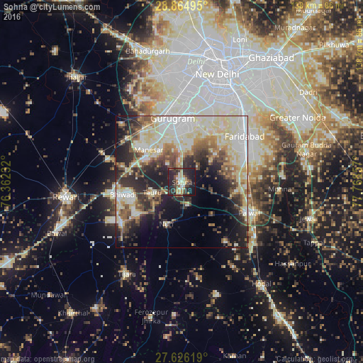
Analysis of Sohna night lights 2016
Square area 10x10 km:
 2.18%
2.18%90-99
9.33%80-89
7.14%70-79
5.75%60-69
2.58%50-59
4.56%40-49
9.92%30-39
12.7%20-29
26.59%10-19
19.25%0-9
0%Square area 50x50 km:
8.6%90-99
10.63%80-89
9.87%70-79
3.82%60-69
4.4%50-59
5.52%40-49
5.71%30-39
6.33%20-29
10.07%10-19
12.32%0-9
22.75%Clear (daylight) street map image can be seen on geolist.org.
Map coordinates:
28° 51' 53.8" North, 76° 21' 44.4" East
28° 14' 50.5" North, 77° 3' 55.6" East
27° 37' 34.3" North, 77° 46' 6.9" East
Some cities around Sohna sort by population:
• Faridabad
30.3 km =18.8 mi,  53°
53°
• Gurgaon
24 km =14.9 mi,  350°
350°
• Palwal
27.9 km =17.3 mi,  114°
114°
• Bhiwadi
20.5 km =12.7 mi,  258°
258°
• Dhāruhera
26.7 km =16.6 mi, 259°
• Tāoru
12 km =7.5 mi,  250°
250°
• Pataudi
29.4 km =18.3 mi,  287°
287°
• Nūh
17.2 km =10.7 mi,  201°
201°
1255870 (p: 33,361)
Sources (retrieved 2019-11-25):
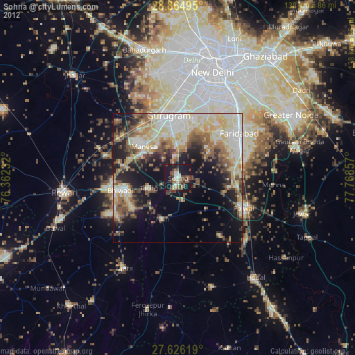
» Earth at Night: Flat Maps 2012, 2016