Shāhābād night lights from space
Night Light of Shāhābād (Uttar Pradesh) from space (India) Src. Average luminocity for 10x10km area is 13.131% and for 50x50km: 5.7035%.
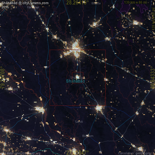
Analysis of Shāhābād night lights 2016
Square area 10x10 km:
 2.78%
2.78%90-99
2.78%80-89
0.79%70-79
0.79%60-69
1.59%50-59
0.79%40-49
1.39%30-39
1.39%20-29
1.59%10-19
1.19%0-9
84.92%Square area 50x50 km:
0.51%90-99
0.93%80-89
0.67%70-79
0.51%60-69
0.69%50-59
0.63%40-49
1.13%30-39
1.18%20-29
2.07%10-19
3.43%0-9
88.24%Clear (daylight) street map image can be seen on geolist.org.
Map coordinates:
28° 15' 51" North, 79° 14' 13.5" East
27° 38' 35.2" North, 79° 56' 24.7" East
27° 1' 6.5" North, 80° 38' 36" East
Some cities around Shāhābād sort by population:
• Shāhjānpur
26.7 km =16.6 mi,  353°
353°
• Hardoī
33.4 km =20.8 mi,  145°
145°
• Jalālābād
29.5 km =18.3 mi,  288°
288°
• Pihānī
26.1 km =16.2 mi,  95°
95°
• Sāndi
39.4 km =24.5 mi,  178°
178°
• Kānt
23.7 km =14.7 mi,  321°
321°
• Allāhganj
27.2 km =16.9 mi,  246°
246°
• Gopāmau
36.1 km =22.4 mi,  109°
109°
1256755 (p: 73,606)
Sources (retrieved 2019-11-25):
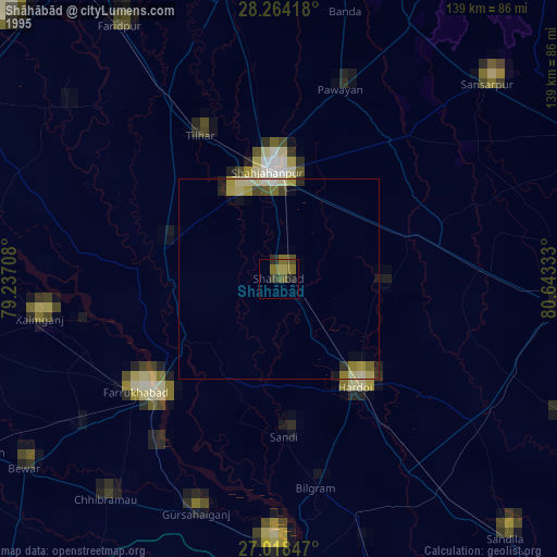
» NASA, Earths city lights 1995
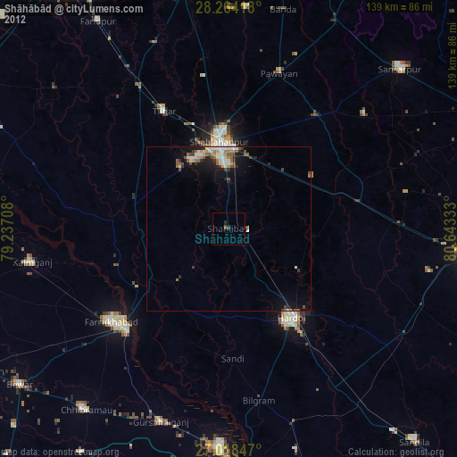
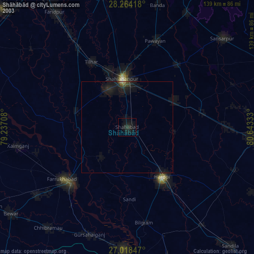
» NASA city lights 2003
» Earth at Night: Flat Maps 2012, 2016