Sangāreddi night lights from space
Night Light of Sangāreddi (Telangana) from space (India) Src. Average luminocity for 10x10km area is 59.1508% and for 50x50km: 26.9378%.
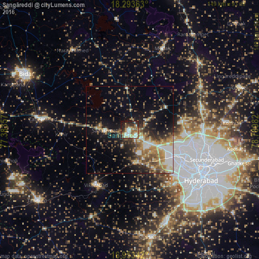
Analysis of Sangāreddi night lights 2016
Square area 10x10 km:
 10.33%
90-99
14.67%80-89
7.02%70-79
9.09%60-69
8.26%50-59
11.78%40-49
5.79%30-39
7.02%20-29
14.67%10-19
10.74%0-9
0.62%Square area 50x50 km:
3.6%90-99
4.04%80-89
2.96%70-79
3.81%60-69
4.66%50-59
4.55%40-49
4.64%30-39
4.39%20-29
6.21%10-19
12.65%0-9
48.48%Clear (daylight) street map image can be seen on geolist.org.
Map coordinates:
18° 17' 37.1" North, 77° 23' 0.9" East
17° 37' 29.2" North, 78° 5' 12.1" East
16° 57' 12.3" North, 78° 47' 23.4" East
Some cities around Sangāreddi sort by population:
• Kūkatpalli
38 km =23.6 mi,  114°
114°
• Serilingampalle
27.1 km =16.8 mi,  122°
122°
• Patancheru
21.4 km =13.3 mi, 118°
• Vikārābād
37.3 km =23.2 mi,  211°
211°
• Sadāseopet
14.2 km =8.8 mi,  267°
267°
• Andol
21.1 km =13.1 mi,  357°
357°
• Singāpur
17.7 km =11 mi,  166°
166°
• Chandūr
27.8 km =17.3 mi,  2°
2°
1257431 (p: 59,199)
Sources (retrieved 2019-11-25):
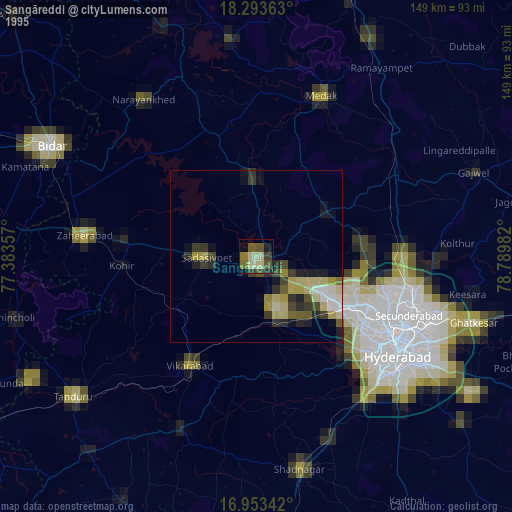
» NASA, Earths city lights 1995
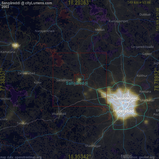
» NASA city lights 2003
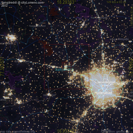
» Earth at Night: Flat Maps 2012, 2016