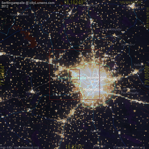
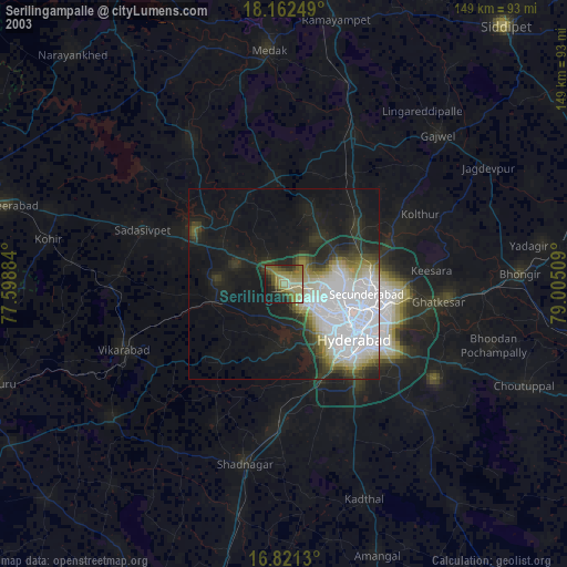
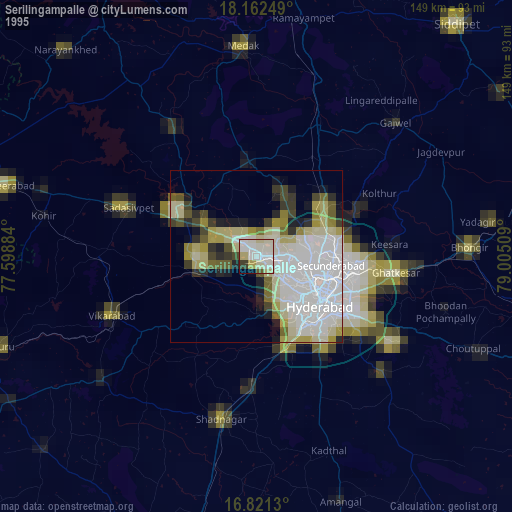
Serilingampalle night lights from space
Night Light of Serilingampalle (Telangana) from space (India) Src. Average luminocity for 10x10km area is 94.9876% and for 50x50km: 63.0674%.
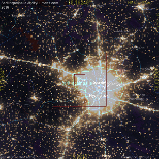
Analysis of Serilingampalle night lights 2016
Square area 10x10 km:
 54.34%
90-99
29.55%80-89
3.31%70-79
5.79%60-69
7.02%50-59
0%40-49
0%30-39
0%20-29
0%10-19
0%0-9
0%Square area 50x50 km:
28.57%90-99
10.96%80-89
5.13%70-79
5.73%60-69
6.47%50-59
5.65%40-49
5.95%30-39
4.73%20-29
6.94%10-19
10.59%0-9
9.28%Clear (daylight) street map image can be seen on geolist.org.
Map coordinates:
18° 9' 45" North, 77° 35' 55.8" East
17° 29' 35.3" North, 78° 18' 7.1" East
16° 49' 16.7" North, 79° 0' 18.3" East
Some cities around Serilingampalle sort by population:
• Hyderabad
20.4 km =12.7 mi,  126°
126°
• Kūkatpalli
11.9 km =7.4 mi,  94°
94°
• Quthbullapur
16.6 km =10.3 mi, 86°
• Secunderabad
25.6 km =15.9 mi, 87°
• Malkajgiri
24.3 km =15.1 mi,  101°
101°
• Patancheru
6 km =3.7 mi,  318°
318°
• Singāpur
18.9 km =11.7 mi,  262°
262°
• Srīrāmnagar
25.7 km =16 mi,  191°
191°
7302856 (p: 150,525)
Sources (retrieved 2019-11-25):
» NASA, Earths city lights 1995
» NASA city lights 2003
» Earth at Night: Flat Maps 2012, 2016