Sadāseopet night lights from space
Night Light of Sadāseopet (Telangana) from space (India) Src. Average luminocity for 10x10km area is 32.5248% and for 50x50km: 17.577%.
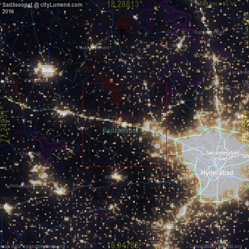
Analysis of Sadāseopet night lights 2016
Square area 10x10 km:
 1.86%
1.86%90-99
4.34%80-89
3.93%70-79
8.47%60-69
3.51%50-59
3.93%40-49
3.93%30-39
4.75%20-29
5.17%10-19
53.51%0-9
6.61%Square area 50x50 km:
1.31%90-99
2.14%80-89
1.75%70-79
2.24%60-69
2.6%50-59
3.77%40-49
3.44%30-39
3.7%20-29
4.8%10-19
11.19%0-9
63.05%Clear (daylight) street map image can be seen on geolist.org.
Map coordinates:
18° 17' 17.3" North, 77° 14' 58.2" East
17° 37' 9.3" North, 77° 57' 9.5" East
16° 56' 52.4" North, 78° 39' 20.7" East
Some cities around Sadāseopet sort by population:
• Serilingampalle
39.6 km =24.6 mi,  110°
110°
• Sangāreddi
14.2 km =8.8 mi,  87°
87°
• Patancheru
34.4 km =21.4 mi, 106°
• Zahirābād
37.2 km =23.1 mi,  280°
280°
• Vikārābād
31.7 km =19.7 mi,  189°
189°
• Andol
25.4 km =15.8 mi,  31°
31°
• Singāpur
24.8 km =15.4 mi,  132°
132°
• Chandūr
32.4 km =20.1 mi, 28°
1257890 (p: 37,245)
Sources (retrieved 2019-11-25):
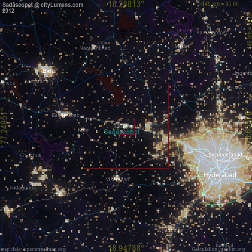
» Earth at Night: Flat Maps 2012, 2016