Rājgarh night lights from space
Night Light of Rājgarh (Rajasthan) from space (India) Src. Average luminocity for 10x10km area is 8.0625% and for 50x50km: 0.4283%.
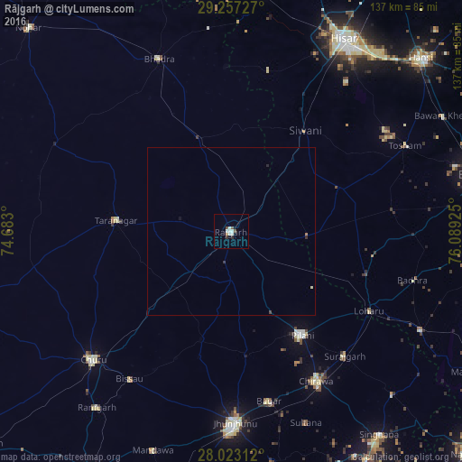
Analysis of Rājgarh night lights 2016
Square area 10x10 km:
 1.7%
1.7%90-99
2.84%80-89
0%70-79
0%60-69
0.76%50-59
0.95%40-49
1.33%30-39
0.19%20-29
1.33%10-19
0%0-9
90.91%Square area 50x50 km:
0.07%90-99
0.12%80-89
0.02%70-79
0%60-69
0.06%50-59
0.04%40-49
0.07%30-39
0.07%20-29
0.08%10-19
0.03%0-9
99.43%Clear (daylight) street map image can be seen on geolist.org.
Map coordinates:
29° 15' 26.2" North, 74° 40' 58.8" East
28° 38' 31.2" North, 75° 23' 10" East
28° 1' 23.2" North, 76° 5' 21.3" East
Some cities around Rājgarh sort by population:
• Chidawa
51.2 km =31.8 mi,  150°
150°
• Bhādra
55.4 km =34.4 mi,  337°
337°
• Tārānagar
34.7 km =21.6 mi,  274°
274°
• Pilāni
37.2 km =23.1 mi, 145°
• Bissāu
53.3 km =33.1 mi,  214°
214°
• Sūrajgarh
50.1 km =31.1 mi,  137°
137°
• Bagar
51.7 km =32.1 mi,  167°
167°
• Lohāru
47.5 km =29.5 mi,  119°
119°
1258868 (p: 49,583)
Sources (retrieved 2019-11-25):
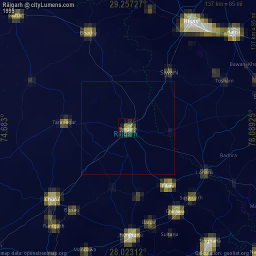
» NASA, Earths city lights 1995
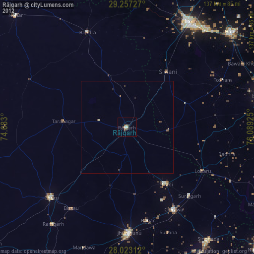
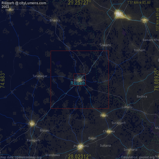
» NASA city lights 2003
» Earth at Night: Flat Maps 2012, 2016