Raia night lights from space
Night Light of Raia (Goa) from space (India) Src. Average luminocity for 10x10km area is 74.5434% and for 50x50km: 30.3104%.
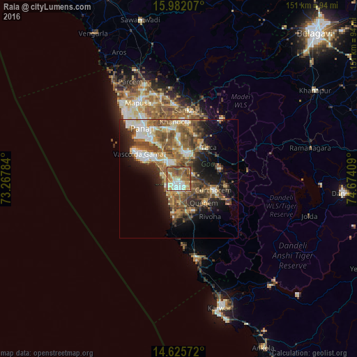
Analysis of Raia night lights 2016
Square area 10x10 km:
100  11.16%
90-99 20.25%
80-89 10.95%
70-79 11.78%
60-69 21.69%
50-59 15.91%
40-49 7.02%
30-39 1.24%
20-29 0%
10-19 0%
0-9 0%
11.16%90-99
20.25%80-89
10.95%70-79
11.78%60-69
21.69%50-59
15.91%40-49
7.02%30-39
1.24%20-29
0%10-19
0%0-9
0%Square area 50x50 km:
100 3.14%
90-99 6.16%
80-89 3.72%
70-79 3.79%
60-69 5.65%
50-59 7.28%
40-49 6.08%
30-39 4.2%
20-29 6.13%
10-19 9.71%
0-9 44.15%
3.14%90-99
6.16%80-89
3.72%70-79
3.79%60-69
5.65%50-59
7.28%40-49
6.08%30-39
4.2%20-29
6.13%10-19
9.71%0-9
44.15%Clear (daylight) street map image can be seen on geolist.org.
Map coordinates:
15° 58' 55.5" North, 73° 16' 4.2" East
15° 18' 18" North, 73° 58' 15.5" East
14° 37' 32.6" North, 74° 40' 26.7" East
Some cities around Raia sort by population:
• Madgaon
3.6 km =2.2 mi,  202°
202°
• Sancoale
10.9 km =6.8 mi,  318°
318°
• Colva
5.9 km =3.7 mi,  241°
241°
• Davorlim
4.3 km =2.7 mi,  147°
147°
• Benaulim
6.4 km =4 mi,  225°
225°
• Chinchinim
10.1 km =6.3 mi,  177°
177°
• Queula
9.6 km =6 mi,  9°
9°
• Varca
8.6 km =5.3 mi, 200°
1259017 (p: 9,421)
Sources (retrieved 2019-11-25):
» Earth at Night: Flat Maps 2012, 2016