Periyakulam night lights from space
Night Light of Periyakulam (Tamil Nadu) from space (India) Src. Average luminocity for 10x10km area is 10.9649% and for 50x50km: 3.6129%.
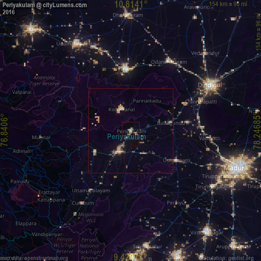
Analysis of Periyakulam night lights 2016
Square area 10x10 km:
 0%
0%90-99
0%80-89
0.83%70-79
3.1%60-69
3.51%50-59
2.07%40-49
3.72%30-39
0.83%20-29
0.41%10-19
1.03%0-9
84.5%Square area 50x50 km:
0.03%90-99
0.11%80-89
0.44%70-79
1.11%60-69
0.38%50-59
0.56%40-49
0.93%30-39
0.5%20-29
0.9%10-19
0.98%0-9
94.07%Clear (daylight) street map image can be seen on geolist.org.
Map coordinates:
10° 48' 50.8" North, 76° 50' 26.2" East
10° 7' 21.6" North, 77° 32' 37.4" East
9° 25' 47.2" North, 78° 14' 48.7" East
Some cities around Periyakulam sort by population:
• Teni
14.4 km =8.9 mi,  210°
210°
• Bodināyakkanūr
24.6 km =15.3 mi,  239°
239°
• Kodaikānāl
14.3 km =8.9 mi,  335°
335°
• Usilampatti
31.6 km =19.6 mi,  122°
122°
• Āndippatti
16.2 km =10.1 mi,  148°
148°
• Vattalkundu
23.9 km =14.9 mi,  79°
79°
• Elumalai
33.3 km =20.7 mi, 149°
• Devadānappatti
11.3 km =7 mi, 76°
1259879 (p: 40,131)
Sources (retrieved 2019-11-25):
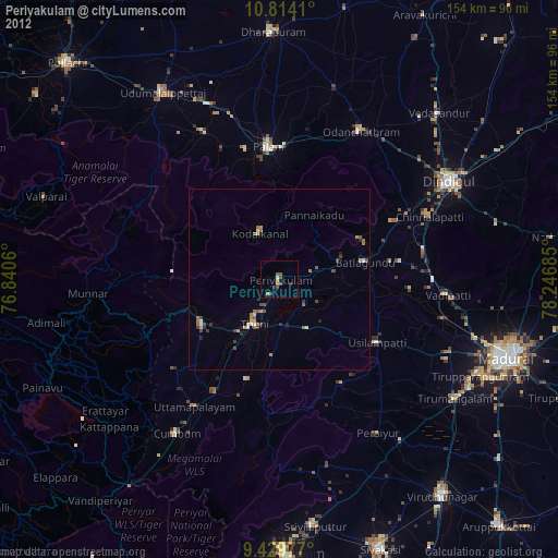
» Earth at Night: Flat Maps 2012, 2016