Patāmundai night lights from space
Night Light of Patāmundai (Odisha) from space (India) Src. Average luminocity for 10x10km area is 17.017% and for 50x50km: 6.9202%.
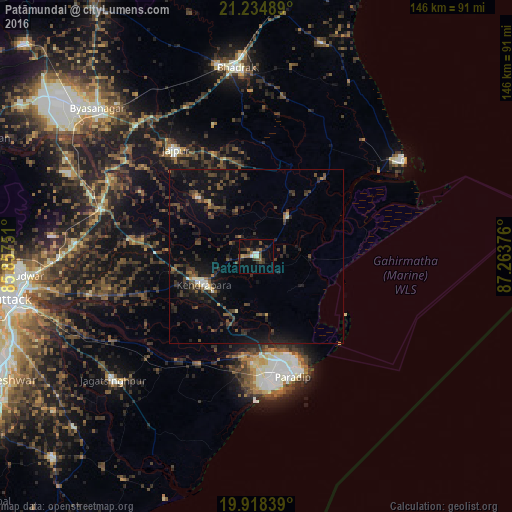
Analysis of Patāmundai night lights 2016
Square area 10x10 km:
 1.33%
1.33%90-99
2.27%80-89
0.57%70-79
0.38%60-69
3.41%50-59
2.27%40-49
4.17%30-39
6.44%20-29
4.17%10-19
7.77%0-9
67.23%Square area 50x50 km:
0.2%90-99
0.48%80-89
0.21%70-79
0.26%60-69
0.42%50-59
1.2%40-49
2.25%30-39
2.3%20-29
3.6%10-19
7.09%0-9
82.01%Clear (daylight) street map image can be seen on geolist.org.
Map coordinates:
21° 14' 5.6" North, 85° 51' 27" East
20° 34' 41" North, 86° 33' 38.3" East
19° 55' 6.2" North, 87° 15' 49.5" East
Some cities around Patāmundai sort by population:
• Cuttack
72.1 km =44.8 mi,  259°
259°
• Bhadrakh
53.2 km =33.1 mi,  354°
354°
• Parādīp Garh
29.5 km =18.3 mi,  170°
170°
• Kendrāparha
16.7 km =10.4 mi,  239°
239°
• Jājpur
38 km =23.6 mi,  322°
322°
• Jagatsinghapur
54.1 km =33.6 mi,  228°
228°
• Bāsudebpur
62.7 km =39 mi,  16°
16°
• Chāndbāli
28.9 km =18 mi,  40°
40°
1260178 (p: 34,400)
Sources (retrieved 2019-11-25):
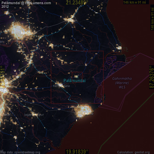
» Earth at Night: Flat Maps 2012, 2016