Pallikondai night lights from space
Night Light of Pallikondai (Tamil Nadu) from space (India) Src. Average luminocity for 10x10km area is 33.4372% and for 50x50km: 16.7051%.
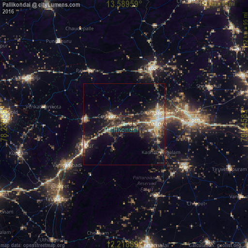
Analysis of Pallikondai night lights 2016
Square area 10x10 km:
 0%
0%90-99
3.03%80-89
5.63%70-79
1.73%60-69
4.11%50-59
7.14%40-49
8.23%30-39
11.47%20-29
21.21%10-19
36.8%0-9
0.65%Square area 50x50 km:
0.65%90-99
2.47%80-89
2.51%70-79
1.3%60-69
1.83%50-59
2.97%40-49
4.15%30-39
5.01%20-29
5.95%10-19
12.13%0-9
61.03%Clear (daylight) street map image can be seen on geolist.org.
Map coordinates:
13° 35' 22.5" North, 78° 14' 22.5" East
12° 54' 18.6" North, 78° 56' 33.7" East
12° 13' 8" North, 79° 38' 45" East
Some cities around Pallikondai sort by population:
• Vellore
20.6 km =12.8 mi,  85°
85°
• Ambur
27.6 km =17.1 mi,  242°
242°
• Gudiyatham
8.7 km =5.4 mi,  301°
301°
• Peranāmpattu
24.5 km =15.2 mi,  277°
277°
• Rāmāpuram
34 km =21.1 mi,  50°
50°
• Kātpādi
23.1 km =14.4 mi,  71°
71°
• Pudūr
24.1 km =15 mi,  64°
64°
• Odugattūr
16.6 km =10.3 mi,  202°
202°
1260685 (p: 21,335)
Sources (retrieved 2019-11-25):
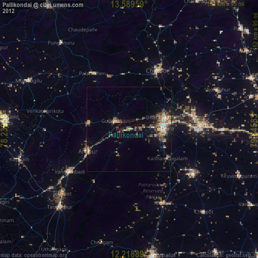
» Earth at Night: Flat Maps 2012, 2016