Gudiyatham night lights from space
Night Light of Gudiyatham (Tamil Nadu) from space (India) Src. Average luminocity for 10x10km area is 37.7229% and for 50x50km: 12.9918%.
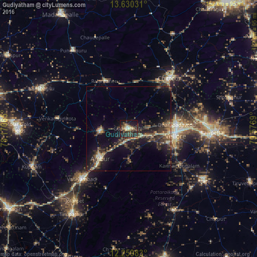
Analysis of Gudiyatham night lights 2016
Square area 10x10 km:
 0%
0%90-99
4.98%80-89
6.49%70-79
3.46%60-69
3.68%50-59
6.49%40-49
11.69%30-39
14.29%20-29
22.94%10-19
22.29%0-9
3.68%Square area 50x50 km:
0.09%90-99
1.46%80-89
1.52%70-79
0.9%60-69
1.33%50-59
2.55%40-49
3.58%30-39
4.51%20-29
5.49%10-19
11.93%0-9
66.64%Clear (daylight) street map image can be seen on geolist.org.
Map coordinates:
13° 37' 49.1" North, 78° 10' 14.3" East
12° 56' 45.6" North, 78° 52' 25.6" East
12° 15' 35.4" North, 79° 34' 36.8" East
Some cities around Gudiyatham sort by population:
• Vellore
28.2 km =17.5 mi,  96°
96°
• Ambur
24.2 km =15 mi,  224°
224°
• Peranāmpattu
16.8 km =10.4 mi,  265°
265°
• Palmaner
31.4 km =19.5 mi,  334°
334°
• Pallikondai
8.7 km =5.4 mi,  121°
121°
• Kātpādi
29.6 km =18.4 mi,  84°
84°
• Pudūr
29.8 km =18.5 mi, 78°
• Odugattūr
19.8 km =12.3 mi,  177°
177°
1270800 (p: 93,973)
Sources (retrieved 2019-11-25):
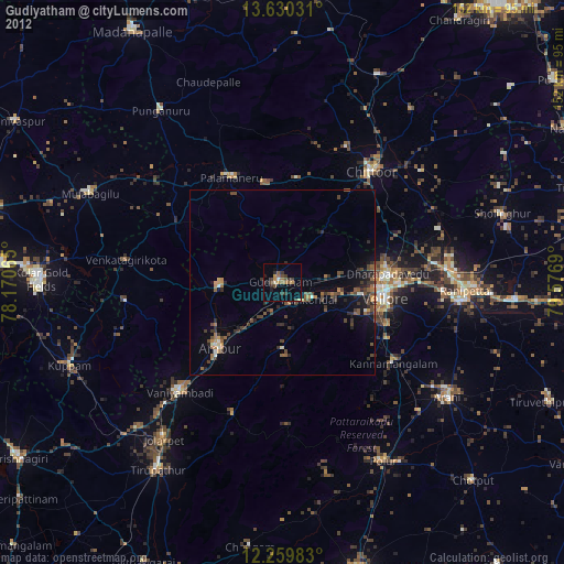
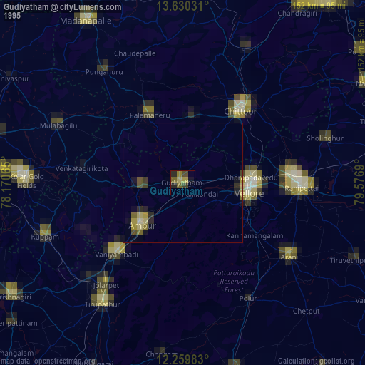
» NASA, Earths city lights 1995
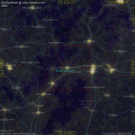
» NASA city lights 2003
» Earth at Night: Flat Maps 2012, 2016