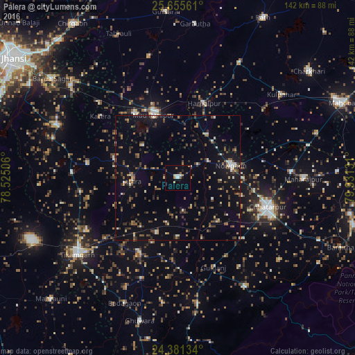
Palera night lights from space
Night Light of Palera (Madhya Pradesh) from space (India) Src. Average luminocity for 10x10km area is 13.3447% and for 50x50km: 11.6337%.
Analysis of Palera night lights 2016
Square area 10x10 km:
 1.89%
1.89%90-99
1.89%80-89
1.33%70-79
1.7%60-69
1.52%50-59
1.52%40-49
0.95%30-39
0.57%20-29
1.7%10-19
2.46%0-9
84.47%Square area 50x50 km:
0.73%90-99
1.01%80-89
0.94%70-79
0.75%60-69
1.67%50-59
2.02%40-49
2.48%30-39
2.39%20-29
2.37%10-19
6.83%0-9
78.8%Clear (daylight) street map image can be seen on geolist.org.
Map coordinates:
25° 39' 20.2" North, 78° 31' 30.2" East
25° 1' 12.5" North, 79° 13' 41.4" East
24° 22' 52.8" North, 79° 55' 52.7" East
Some cities around Palera sort by population:
• Chhatarpur
38.1 km =23.7 mi,  107°
107°
• Tīkamgarh
50.6 km =31.4 mi,  232°
232°
• Rānīpur
30.6 km =19 mi,  326°
326°
• Harpālpur
31.6 km =19.6 mi,  19°
19°
• Jatāra
18.1 km =11.2 mi,  266°
266°
• Khargāpur
23.5 km =14.6 mi,  201°
201°
• Tori-Fatehpur
49.7 km =30.9 mi,  346°
346°
• Baldeogarh
33.5 km =20.8 mi,  208°
208°
1260734 (p: 16,554)
Sources (retrieved 2019-11-25):
» Earth at Night: Flat Maps 2012, 2016