Naihāti night lights from space
Night Light of Naihāti (West Bengal) from space (India) Src. Average luminocity for 10x10km area is 95.1329% and for 50x50km: 56.715%.
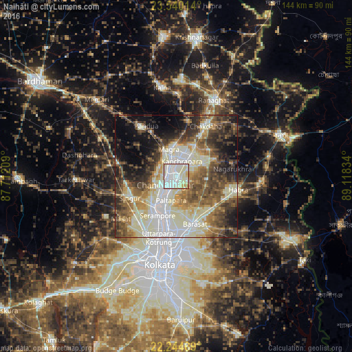
Analysis of Naihāti night lights 2016
Square area 10x10 km:
 32.54%
90-99
54.96%80-89
7.54%70-79
3.17%60-69
1.79%50-59
0%40-49
0%30-39
0%20-29
0%10-19
0%0-9
0%Square area 50x50 km:
9.2%90-99
18.43%80-89
7.03%70-79
5.16%60-69
7.09%50-59
9.01%40-49
9.27%30-39
7.78%20-29
8.56%10-19
9.71%0-9
8.78%Clear (daylight) street map image can be seen on geolist.org.
Map coordinates:
23° 32' 24.5" North, 87° 42' 43.5" East
22° 53' 38.3" North, 88° 24' 54.8" East
22° 14' 40.9" North, 89° 7' 6" East
Some cities around Naihāti sort by population:
• Bhātpāra
3.4 km =2.1 mi,  205°
205°
• Chandannagar
6 km =3.7 mi,  233°
233°
• Hugli
2.5 km =1.6 mi,  311°
311°
• Kānchrāpāra
7.5 km =4.7 mi,  10°
10°
• Hālīsahar
4.3 km =2.7 mi,  4°
4°
• Bānsbāria
6.8 km =4.2 mi,  347°
347°
• Rāmchandrapur
6.2 km =3.9 mi,  87°
87°
• Sankarpur
6.3 km =3.9 mi,  143°
143°
1262131 (p: 253,221)
Sources (retrieved 2019-11-25):
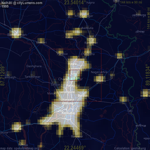
» NASA, Earths city lights 1995
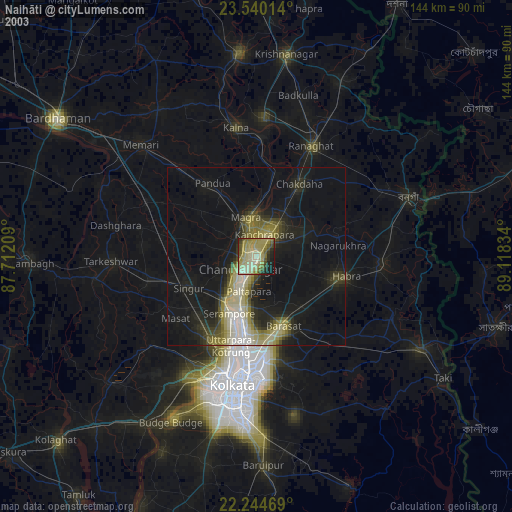
» NASA city lights 2003
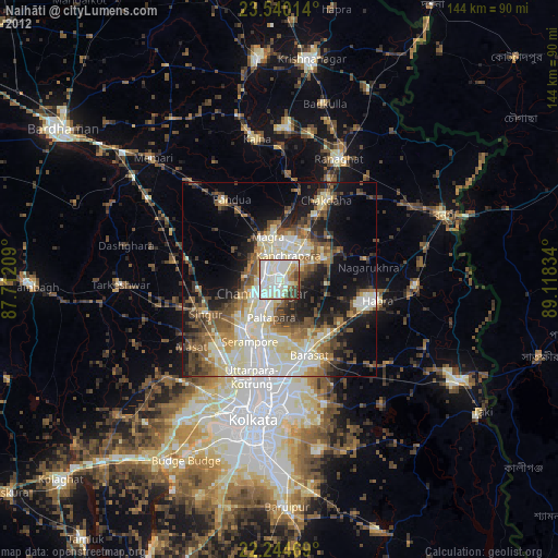
» Earth at Night: Flat Maps 2012, 2016