Bānsbāria night lights from space
Night Light of Bānsbāria (West Bengal) from space (India) Src. Average luminocity for 10x10km area is 93.1488% and for 50x50km: 49.7462%.
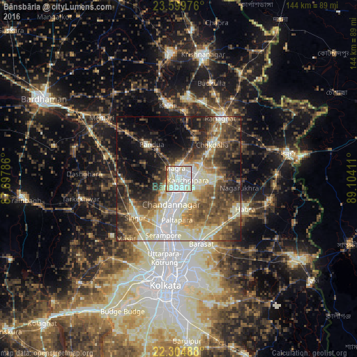
Analysis of Bānsbāria night lights 2016
Square area 10x10 km:
 27.58%
90-99
56.55%80-89
7.34%70-79
2.98%60-69
2.78%50-59
1.39%40-49
0.99%30-39
0.4%20-29
0%10-19
0%0-9
0%Square area 50x50 km:
6.44%90-99
14.64%80-89
6.11%70-79
4.88%60-69
6.66%50-59
8.87%40-49
9.16%30-39
8.19%20-29
9.46%10-19
11.37%0-9
14.22%Clear (daylight) street map image can be seen on geolist.org.
Map coordinates:
23° 35' 59.1" North, 87° 41' 52.3" East
22° 57' 13.9" North, 88° 24' 3.5" East
22° 18' 17.6" North, 89° 6' 14.8" East
Some cities around Bānsbāria sort by population:
• Bhātpāra
9.7 km =6 mi,  179°
179°
• Naihāti
6.8 km =4.2 mi,  167°
167°
• Chandannagar
10.7 km =6.6 mi,  198°
198°
• Hugli
5 km =3.1 mi, 184°
• Kānchrāpāra
2.9 km =1.8 mi,  76°
76°
• Hālīsahar
3 km =1.9 mi,  143°
143°
• Kalyani
9 km =5.6 mi,  68°
68°
• Rāmchandrapur
9.9 km =6.2 mi,  130°
130°
1277240 (p: 108,474)
Sources (retrieved 2019-11-25):
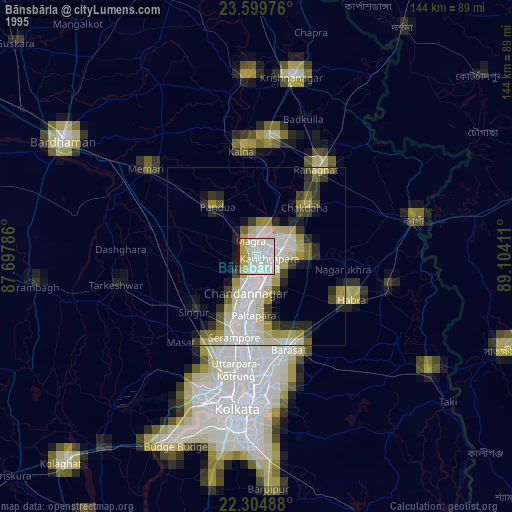
» NASA, Earths city lights 1995
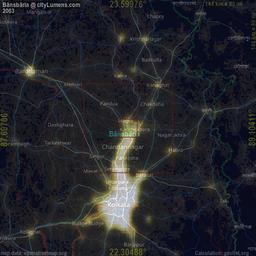
» NASA city lights 2003
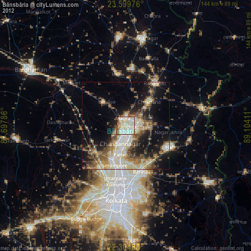
» Earth at Night: Flat Maps 2012, 2016