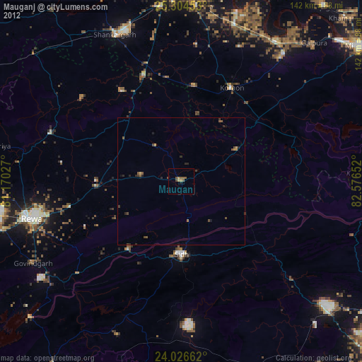
Mauganj night lights from space
Night Light of Mauganj (Madhya Pradesh) from space (India) Src. Average luminocity for 10x10km area is 16.7143% and for 50x50km: 5.2352%.
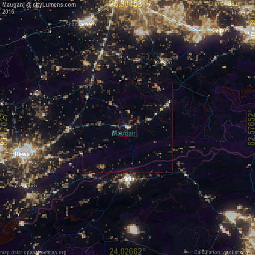
Analysis of Mauganj night lights 2016
Square area 10x10 km:
 1.19%
1.19%90-99
1.98%80-89
0.6%70-79
1.79%60-69
1.59%50-59
2.18%40-49
3.77%30-39
6.55%20-29
5.75%10-19
5.16%0-9
69.44%Square area 50x50 km:
0.16%90-99
0.23%80-89
0.3%70-79
0.35%60-69
0.45%50-59
0.79%40-49
1.37%30-39
2.18%20-29
2.45%10-19
2.75%0-9
88.98%Clear (daylight) street map image can be seen on geolist.org.
Map coordinates:
25° 18' 16.3" North, 81° 10' 13" East
24° 40' 2" North, 81° 52' 24.2" East
24° 1' 35.8" North, 82° 34' 35.5" East
Some cities around Mauganj sort by population:
• Sidhi
29.3 km =18.2 mi,  178°
178°
• Teonthar
42.1 km =26.2 mi,  326°
326°
• Chorhat
33.7 km =20.9 mi,  217°
217°
• Gurh
41.9 km =26 mi,  244°
244°
• Mangawān
33 km =20.5 mi,  270°
270°
• Baikunthpur
47.3 km =29.4 mi,  278°
278°
• Naīgarhi
16.4 km =10.2 mi,  324°
324°
• Sohāgi
39.3 km =24.4 mi, 332°
1263300 (p: 25,537)
Sources (retrieved 2019-11-25):
» Earth at Night: Flat Maps 2012, 2016