Madhyamgram night lights from space
Night Light of Madhyamgram (West Bengal) from space (India) Src. Average luminocity for 10x10km area is 97.6071% and for 50x50km: 74.6576%.
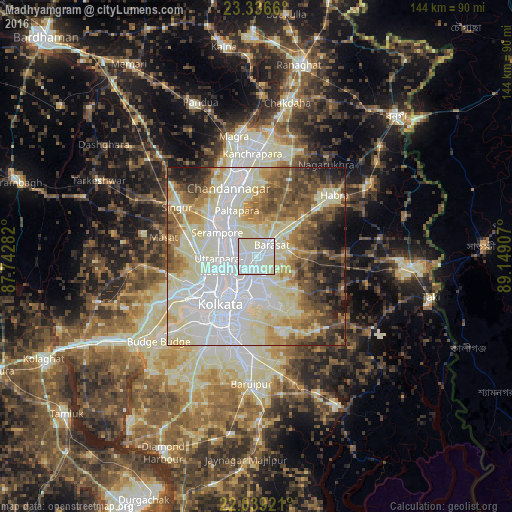
Analysis of Madhyamgram night lights 2016
Square area 10x10 km:
 47.02%
90-99
52.38%80-89
0.6%70-79
0%60-69
0%50-59
0%40-49
0%30-39
0%20-29
0%10-19
0%0-9
0%Square area 50x50 km:
23.15%90-99
24.54%80-89
9.3%70-79
6.07%60-69
7.26%50-59
8.09%40-49
7.07%30-39
5.2%20-29
4.66%10-19
4.16%0-9
0.51%Clear (daylight) street map image can be seen on geolist.org.
Map coordinates:
23° 20' 11.8" North, 87° 44' 34.2" East
22° 41' 22" North, 88° 26' 45.4" East
22° 2' 21.2" North, 89° 8' 56.7" East
Some cities around Madhyamgram sort by population:
• Pānihāti
7.4 km =4.6 mi,  271°
271°
• Kāmārhāti
7.6 km =4.7 mi,  254°
254°
• Bārāsat
5.1 km =3.2 mi,  46°
46°
• Baranagar
8.8 km =5.5 mi,  232°
232°
• Khardah
7.7 km =4.8 mi,  294°
294°
• Dam Dam
6.7 km =4.2 mi,  200°
200°
• Garui
7.8 km =4.8 mi,  217°
217°
• Sodpur
5.8 km =3.6 mi, 286°
1264543 (p: 161,126)
Sources (retrieved 2019-11-25):
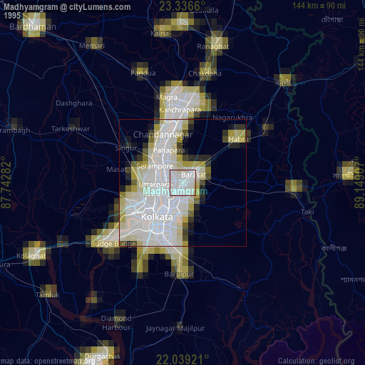
» NASA, Earths city lights 1995
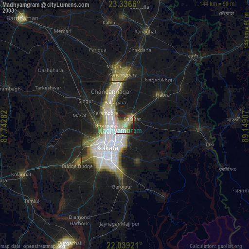
» NASA city lights 2003
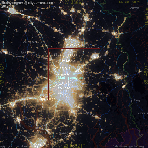
» Earth at Night: Flat Maps 2012, 2016