Kuchinda night lights from space
Night Light of Kuchinda (Odisha) from space (India) Src. Average luminocity for 10x10km area is 5.9881% and for 50x50km: 2.9394%.
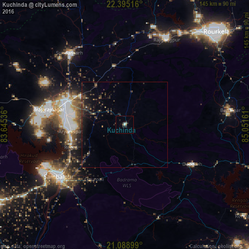
Analysis of Kuchinda night lights 2016
Square area 10x10 km:
 0.79%
0.79%90-99
0.79%80-89
0.79%70-79
0.79%60-69
0%50-59
0.79%40-49
0%30-39
1.98%20-29
3.97%10-19
0.79%0-9
89.29%Square area 50x50 km:
0.06%90-99
0.11%80-89
0.13%70-79
0.15%60-69
0.11%50-59
0.39%40-49
0.97%30-39
1.22%20-29
1.76%10-19
3.05%0-9
92.04%Clear (daylight) street map image can be seen on geolist.org.
Map coordinates:
22° 23' 42.6" North, 83° 38' 43.3" East
21° 44' 36.8" North, 84° 20' 54.5" East
21° 5' 20.4" North, 85° 3' 5.8" East
Some cities around Kuchinda sort by population:
• Sambalpur
49.4 km =30.7 mi,  231°
231°
• Jharsuguda
37.4 km =23.2 mi,  289°
289°
• Brājarājnagar
45.3 km =28.1 mi,  280°
280°
• Sundargarh
52.7 km =32.7 mi,  321°
321°
• Burla
55.6 km =34.5 mi,  242°
242°
• Hīrākud
54.8 km =34.1 mi, 243°
• Deogarh
45.9 km =28.5 mi,  119°
119°
• Rengāli
32.4 km =20.1 mi,  250°
250°
1266433 (p: 14,081)
Sources (retrieved 2019-11-25):
» Earth at Night: Flat Maps 2012, 2016