Koregaon night lights from space
Night Light of Koregaon (Maharashtra) from space (India) Src. Average luminocity for 10x10km area is 59.1074% and for 50x50km: 48.4178%.
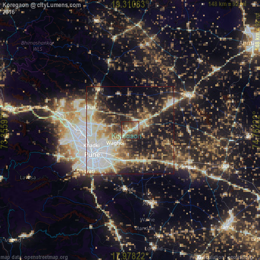
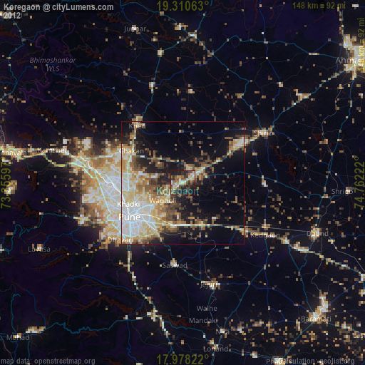
Analysis of Koregaon night lights 2016
Square area 10x10 km:
 1.24%
1.24%90-99
20.45%80-89
4.34%70-79
6.61%60-69
10.74%50-59
15.7%40-49
16.94%30-39
10.33%20-29
12.81%10-19
0.83%0-9
0%Square area 50x50 km:
8.17%90-99
13.32%80-89
4.72%70-79
4.98%60-69
6.03%50-59
7.11%40-49
7.73%30-39
8.54%20-29
12.83%10-19
15.89%0-9
10.68%Clear (daylight) street map image can be seen on geolist.org.
Map coordinates:
19° 18' 38.3" North, 73° 21' 21.5" East
18° 38' 44.6" North, 74° 3' 32.7" East
17° 58' 41.6" North, 74° 45' 44" East
Some cities around Koregaon sort by population:
• Pune
25.6 km =15.9 mi,  236°
236°
• Pimpri
26.7 km =16.6 mi,  264°
264°
• Shivaji Nagar
25.3 km =15.7 mi, 239°
• Khadki
23.7 km =14.7 mi,  247°
247°
• Chākan
24.2 km =15 mi,  301°
301°
• Alandi
17.3 km =10.7 mi,  281°
281°
• Rājgurunagar
29.7 km =18.5 mi,  325°
325°
• Lohogaon
14.8 km =9.2 mi, 249°
1266116 (p: 25,846)
Sources (retrieved 2019-11-25):
» Earth at Night: Flat Maps 2012, 2016