Khonsa night lights from space
Night Light of Khonsa (Arunachal Pradesh) from space (India) Src. Average luminocity for 10x10km area is 0.0278% and for 50x50km: 0.786%.
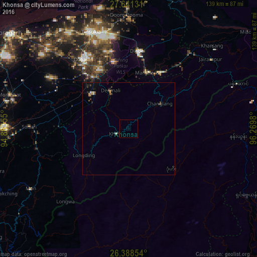
Analysis of Khonsa night lights 2016
Square area 10x10 km:
 0%
0%90-99
0%80-89
0%70-79
0%60-69
0%50-59
0%40-49
0%30-39
0%20-29
0%10-19
0%0-9
100%Square area 50x50 km:
0.05%90-99
0.08%80-89
0.02%70-79
0.06%60-69
0.09%50-59
0.19%40-49
0.2%30-39
0.15%20-29
0.17%10-19
0.38%0-9
98.6%Clear (daylight) street map image can be seen on geolist.org.
Map coordinates:
27° 38' 28.7" North, 94° 51' 48.8" East
27° 1' 0" North, 95° 34' 0" East
26° 23' 18.7" North, 96° 16' 11.3" East
Some cities around Khonsa sort by population:
• Tinsukia
56.4 km =35 mi,  338°
338°
• Margherita
31.5 km =19.6 mi,  18°
18°
• Duliāgaon
47.1 km =29.3 mi,  327°
327°
• Digboi
42.2 km =26.2 mi,  6°
6°
• Sonāri
54.5 km =33.9 mi,  270°
270°
• Nāmrup
31.4 km =19.5 mi,  308°
308°
• Mākum
53.8 km =33.4 mi,  346°
346°
• Nahorkatiya
37.6 km =23.4 mi,  323°
323°
1266668 (p: 10,187)
Sources (retrieved 2019-11-25):
» Earth at Night: Flat Maps 2012, 2016