Karamsad night lights from space
Night Light of Karamsad (Gujarat) from space (India) Src. Average luminocity for 10x10km area is 60.1856% and for 50x50km: 32.5134%.
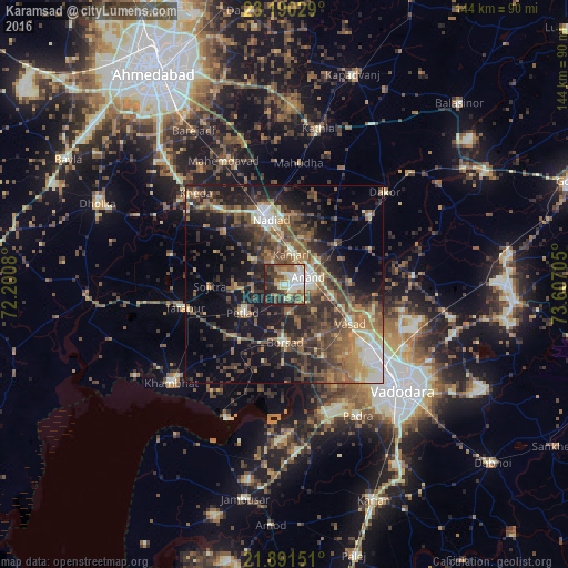
Analysis of Karamsad night lights 2016
Square area 10x10 km:
 3.98%
3.98%90-99
21.59%80-89
8.52%70-79
5.3%60-69
10.23%50-59
8.71%40-49
10.23%30-39
12.69%20-29
14.2%10-19
4.55%0-9
0%Square area 50x50 km:
1.69%90-99
5.24%80-89
3.51%70-79
3.47%60-69
5.97%50-59
7.85%40-49
7.8%30-39
7.86%20-29
10.48%10-19
15.94%0-9
30.19%Clear (daylight) street map image can be seen on geolist.org.
Map coordinates:
23° 11' 25" North, 72° 12' 2.9" East
22° 32' 32.7" North, 72° 54' 14.1" East
21° 53' 29.4" North, 73° 36' 25.4" East
Some cities around Karamsad sort by population:
• Nadiād
17.4 km =10.8 mi,  345°
345°
• Anand
5.4 km =3.4 mi,  77°
77°
• Borsad
15 km =9.3 mi,  182°
182°
• Petlād
12.9 km =8 mi,  235°
235°
• Chaklāsi
13 km =8.1 mi,  18°
18°
• Vallabh Vidyanagar
1.1 km =0.7 mi,  201°
201°
• Sojītra
18.9 km =11.7 mi,  268°
268°
• Vasa
20.2 km =12.6 mi,  310°
310°
1267862 (p: 32,380)
Sources (retrieved 2019-11-25):
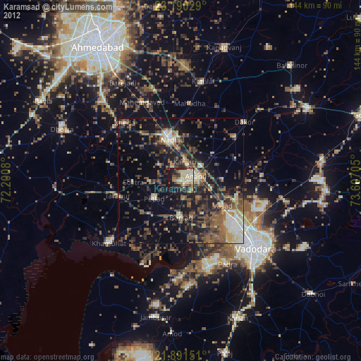
» Earth at Night: Flat Maps 2012, 2016