Kannavam night lights from space
Night Light of Kannavam (Kerala) from space (India) Src. Average luminocity for 10x10km area is 0.126% and for 50x50km: 1.2348%.
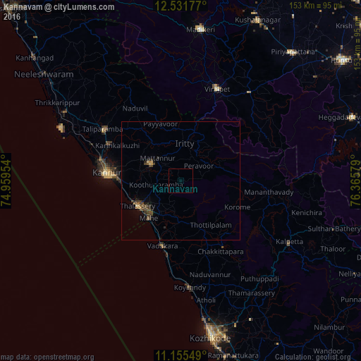
Analysis of Kannavam night lights 2016
Square area 10x10 km:
 0%
0%90-99
0%80-89
0%70-79
0%60-69
0%50-59
0%40-49
0%30-39
0%20-29
0.41%10-19
0%0-9
99.59%Square area 50x50 km:
0%90-99
0.01%80-89
0.19%70-79
0.12%60-69
0.08%50-59
0.29%40-49
0.53%30-39
0.37%20-29
0.38%10-19
0.34%0-9
97.69%Clear (daylight) street map image can be seen on geolist.org.
Map coordinates:
12° 31' 54.4" North, 74° 57' 34.3" East
11° 50' 40.2" North, 75° 39' 45.6" East
11° 9' 19.8" North, 76° 21' 56.8" East
Some cities around Kannavam sort by population:
• Tellicherry
21.4 km =13.3 mi,  239°
239°
• Badagara
28.8 km =17.9 mi,  197°
197°
• Mattanur
13.8 km =8.6 mi,  313°
313°
• Nādāpuram
17.8 km =11.1 mi,  182°
182°
• Mahē
21.1 km =13.1 mi,  221°
221°
• Dharmadam
22.9 km =14.2 mi,  250°
250°
• Muluppilagadu
23.6 km =14.7 mi,  257°
257°
• Perya
20.9 km =13 mi,  93°
93°
1268010 (p: 8,880)
Sources (retrieved 2019-11-25):
» Earth at Night: Flat Maps 2012, 2016