Kalpatta night lights from space
Night Light of Kalpatta (Kerala) from space (India) Src. Average luminocity for 10x10km area is 1.0996% and for 50x50km: 0.0581%.
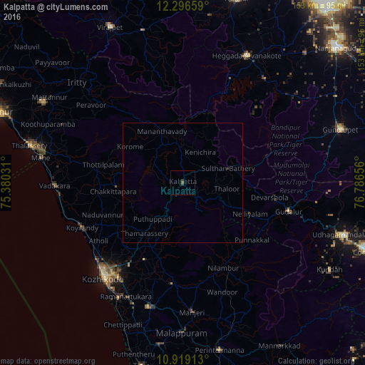
Analysis of Kalpatta night lights 2016
Square area 10x10 km:
 0%
0%90-99
0%80-89
0%70-79
0%60-69
0%50-59
0.87%40-49
0.87%30-39
0%20-29
0.87%10-19
0%0-9
97.4%Square area 50x50 km:
0%90-99
0%80-89
0%70-79
0%60-69
0%50-59
0.03%40-49
0.06%30-39
0.01%20-29
0.03%10-19
0%0-9
99.87%Clear (daylight) street map image can be seen on geolist.org.
Map coordinates:
12° 17' 47.7" North, 75° 22' 49.1" East
11° 36' 31.4" North, 76° 5' 0.3" East
10° 55' 8.9" North, 76° 47' 11.6" East
Some cities around Kalpatta sort by population:
• Kozhikode
52 km =32.3 mi,  219°
219°
• Nādāpuram
47.4 km =29.5 mi,  280°
280°
• Kunnamangalam
40.6 km =25.2 mi,  213°
213°
• Mavoor
42.2 km =26.2 mi, 205°
• Naduvannūr
36.2 km =22.5 mi,  248°
248°
• Iringal
51.1 km =31.8 mi,  263°
263°
• Perya
35.3 km =21.9 mi,  315°
315°
• Panamaram
14.7 km =9.1 mi,  355°
355°
1268327 (p: 29,602)
Sources (retrieved 2019-11-25):
» Earth at Night: Flat Maps 2012, 2016