Kadayanallur night lights from space
Night Light of Kadayanallur (Tamil Nadu) from space (India) Src. Average luminocity for 10x10km area is 13.2403% and for 50x50km: 6.7013%.
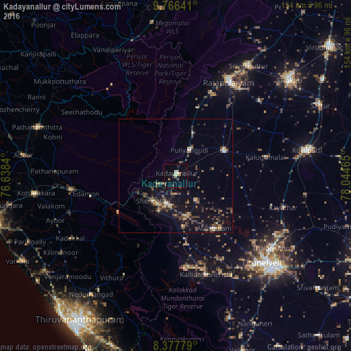
Analysis of Kadayanallur night lights 2016
Square area 10x10 km:
 0.65%
0.65%90-99
2.81%80-89
1.08%70-79
0.87%60-69
2.38%50-59
1.73%40-49
3.25%30-39
0.22%20-29
1.73%10-19
1.08%0-9
84.2%Square area 50x50 km:
0.14%90-99
0.52%80-89
0.58%70-79
0.74%60-69
0.86%50-59
1.04%40-49
2.12%30-39
1.89%20-29
1.72%10-19
5.47%0-9
84.93%Clear (daylight) street map image can be seen on geolist.org.
Map coordinates:
9° 45' 59.1" North, 76° 38' 18.2" East
9° 4' 22" North, 77° 20' 29.5" East
8° 22' 40" North, 78° 2' 40.7" East
Some cities around Kadayanallur sort by population:
• Thenkasi
12.9 km =8 mi,  192°
192°
• Puliyangudi
12.9 km =8 mi,  28°
28°
• Sūrandai
13.8 km =8.6 mi,  141°
141°
• Ālangulam
29 km =18 mi, 143°
• Sivagiri
31.7 km =19.7 mi,  17°
17°
• Vāsudevanallūr
20.3 km =12.6 mi, 22°
• Kalugumalai
40.9 km =25.4 mi,  77°
77°
• Cholapuram
39.8 km =24.7 mi,  38°
38°
1268707 (p: 77,772)
Sources (retrieved 2019-11-25):
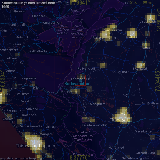
» NASA, Earths city lights 1995
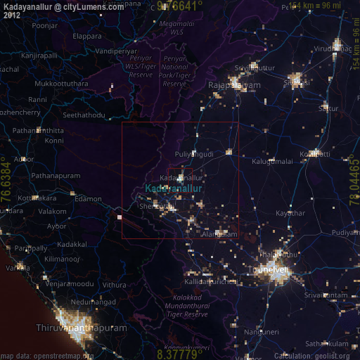
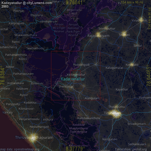
» NASA city lights 2003
» Earth at Night: Flat Maps 2012, 2016