Jhūsi night lights from space
Night Light of Jhūsi (Uttar Pradesh) from space (India) Src. Average luminocity for 10x10km area is 86.8948% and for 50x50km: 52.8245%.
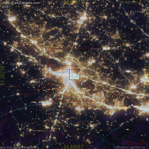
Analysis of Jhūsi night lights 2016
Square area 10x10 km:
 43.06%
90-99
24.01%80-89
6.35%70-79
5.75%60-69
6.35%50-59
5.75%40-49
6.75%30-39
1.98%20-29
0%10-19
0%0-9
0%Square area 50x50 km:
9.03%90-99
8.05%80-89
5.76%70-79
7.75%60-69
9.27%50-59
9.92%40-49
12.16%30-39
11.88%20-29
11.83%10-19
9.52%0-9
4.83%Clear (daylight) street map image can be seen on geolist.org.
Map coordinates:
26° 4' 14.6" North, 81° 12' 8.6" East
25° 26' 14.8" North, 81° 54' 19.8" East
24° 48' 3" North, 82° 36' 31.1" East
Some cities around Jhūsi sort by population:
• Allahābād
6.3 km =3.9 mi,  277°
277°
• Phulpur
22.2 km =13.8 mi,  56°
56°
• Mau Aimma
28.7 km =17.8 mi,  3°
3°
• Handiā
29.4 km =18.3 mi,  106°
106°
• Sarāi Ākil
40.2 km =25 mi,  260°
260°
• Shankargarh
40.5 km =25.2 mi,  225°
225°
• Sirsā
26.9 km =16.7 mi,  135°
135°
• Chail
27.5 km =17.1 mi,  267°
267°
1268929 (p: 16,642)
Sources (retrieved 2019-11-25):
» Earth at Night: Flat Maps 2012, 2016