Jhālrapātan night lights from space
Night Light of Jhālrapātan (Rajasthan) from space (India) Src. Average luminocity for 10x10km area is 56.4306% and for 50x50km: 20.6254%.
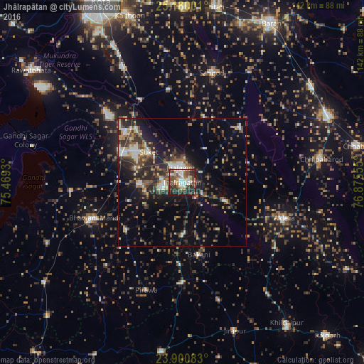
Analysis of Jhālrapātan night lights 2016
Square area 10x10 km:
 7.54%
7.54%90-99
14.88%80-89
5.75%70-79
3.77%60-69
6.15%50-59
8.33%40-49
22.82%30-39
10.32%20-29
17.46%10-19
2.98%0-9
0%Square area 50x50 km:
1.6%90-99
3.43%80-89
1.71%70-79
2.05%60-69
2.15%50-59
3.34%40-49
5.09%30-39
5.08%20-29
7.48%10-19
11.14%0-9
56.93%Clear (daylight) street map image can be seen on geolist.org.
Map coordinates:
25° 10' 48" North, 75° 28' 9.5" East
24° 32' 31.4" North, 76° 10' 20.7" East
23° 54' 3" North, 76° 52' 32" East
Some cities around Jhālrapātan sort by population:
• Jhālāwār
6.1 km =3.8 mi,  352°
352°
• Bhawāniganj
36.9 km =22.9 mi,  247°
247°
• Rāmganj Mandi
25.9 km =16.1 mi,  296°
296°
• Suket
17.6 km =10.9 mi,  311°
311°
• Sunel
29 km =18 mi,  228°
228°
• Khānpur
31 km =19.3 mi,  46°
46°
• Udpura
29.2 km =18.1 mi,  316°
316°
• Bakāni
29.2 km =18.1 mi,  167°
167°
1269020 (p: 33,121)
Sources (retrieved 2019-11-25):
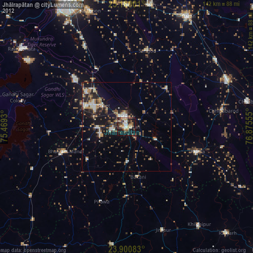
» Earth at Night: Flat Maps 2012, 2016